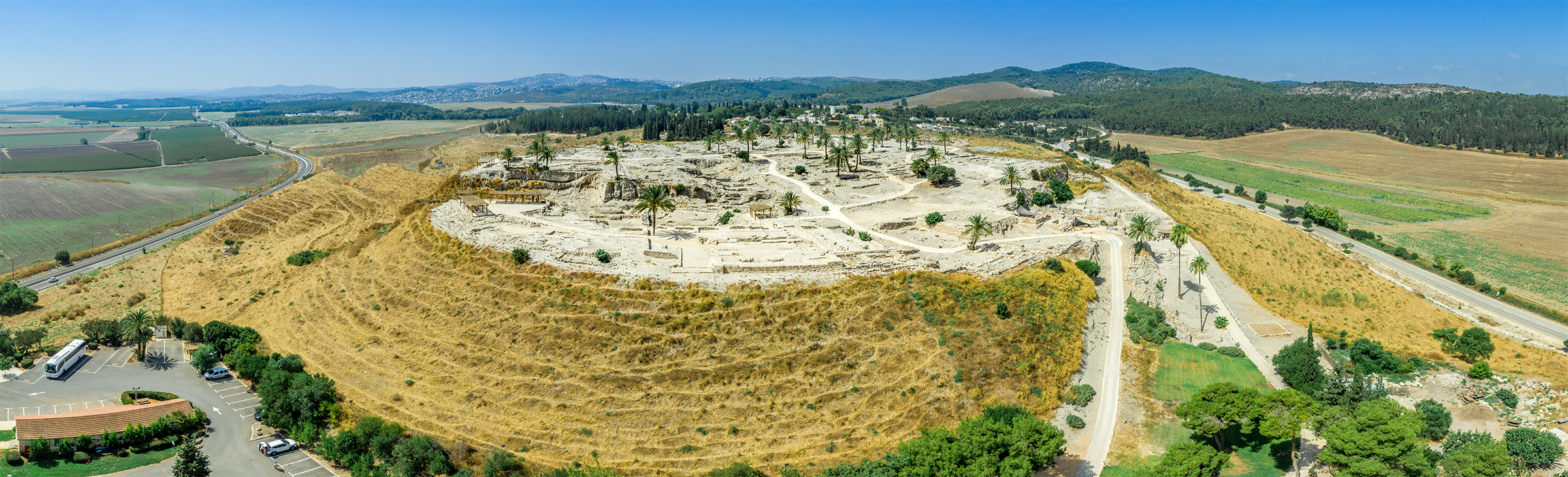


Megiddo
by Galyn Wiemers, Generation Word
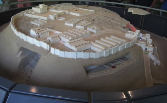
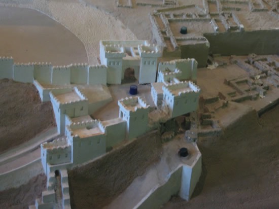
A model of the city of Megiddo.
Notice the gate system on the right side
Notice the opening in the side for the underground tunel for the water supply.
Notice the gate system on the right side
Notice the opening in the side for the underground tunel for the water supply.
A model of the gate to Megiddo. Notice the "L" shape. There is first an entrance into the gate. This is followed by an gate system with six chambers that lead into the city.
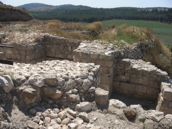
This is the remains of the entrance into the gate in the city of Megiddo.
We walked up and through this. Then we turned to our left to see the remains of the six chamber gate.
We walked up and through this. Then we turned to our left to see the remains of the six chamber gate.
This is three of the six chambers.
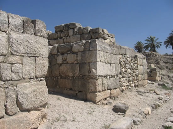
We had to walk up into this gate.
These are on the right side as we walked into the city of Megiddo.
We had to walk up into this gate.
These are on the right side as we walked into the city of Megiddo.
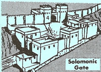
Here is a drawing of the gate system taken from a workbook from the Jerusalem University College we attended for the trip.
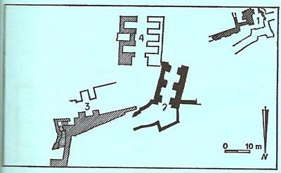
The numbers 3 and 4 match the previous drawing. The 3 is the entrance to the gate system. The 4 is the actual six chamber gate. These are seen in the previous pictures.

This is Toni entering into the water tunnel from the city side. The tunnel will emerge outside the city of Megiddo at the spring of water that supplied water into the city through this tunnel.
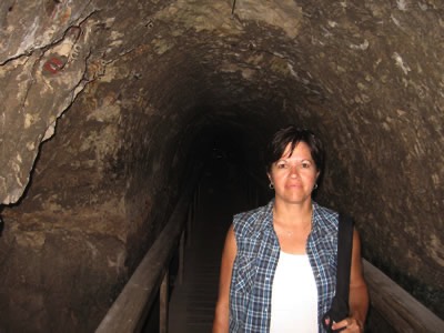
Toni walks under the city of Megiddo towards the water spring on the outside the walls.
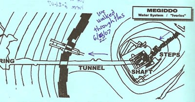
Diagram of the water tunnel that leads out of the city (going to the left) to the Spring of water.
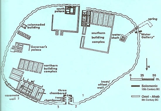
This is a city diagram of Megiddo from the Jerusalem University College located on Mt. Zion in Jerusalem.
Notice the gate and the tunnel.
Solomon built the "black" six chamber gate. Ahab had to rebuild it but used a four chamber gate (here it is labeled as two chamber)
Notice the gate and the tunnel.
Solomon built the "black" six chamber gate. Ahab had to rebuild it but used a four chamber gate (here it is labeled as two chamber)
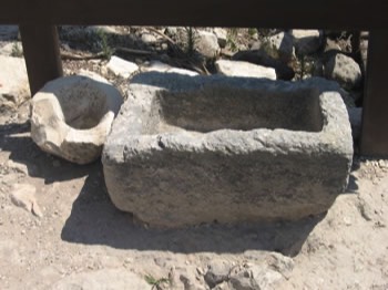
A stone manger at Megiddo.
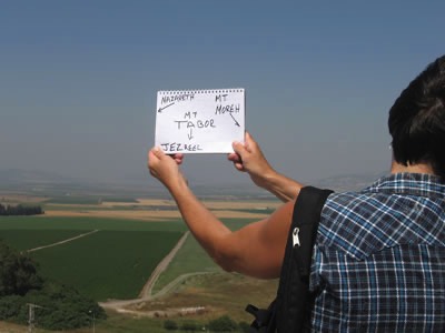
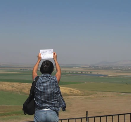
Toni standing on the hill called Megiddo
Hebrew: "Har" means "hill" so the "Hill of Megiddo" would be "Har Megiddo" and without the rough breathing the "h" Har Megiddo is in English "ar megiddo" or "armegiddo" as in "armageddon"
Hebrew: "Har" means "hill" so the "Hill of Megiddo" would be "Har Megiddo" and without the rough breathing the "h" Har Megiddo is in English "ar megiddo" or "armegiddo" as in "armageddon"
As seen in Toni's labeling: The hill to the left is where Nazareth is located. The hill in the middle is Mt. Tabor. To the right is Mt. Moreh with the city of Endor on the back side of it. The very large valley in front extends all the way to Mt. Carmel in the west and the Jordan Valley in the east is called Jezreel Valley. Toni is standing in the ancient ruins of Megiddo looking down.
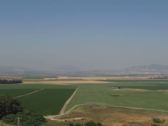
Now Mt. Moreh is in the left of the picture with Endor on the back side. To the right is the hill called Mt. Gilboa. Saul camped here in his last battle against the Philistines. One night he slipped over to Endor to meet with the witch and died the next day on Mt. Gilboa with his son Jonathan.
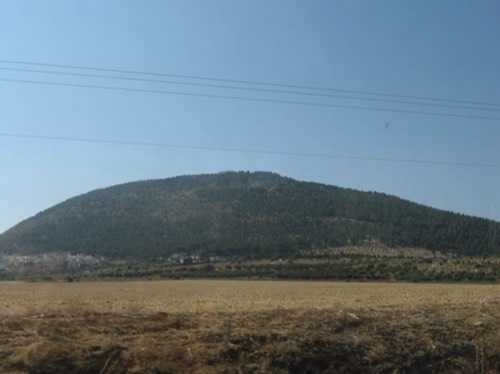
Mt. Tabor as we drive towards the Sea of Galilee from Megiddo and through the Jezreel Valley.
Megiddo Water System from Galyn Wiemers on Vimeo.
Mangers in Megiddo from Galyn Wiemers on Vimeo.

Generation Word Provides:

A Bible Teaching Ministry
of Galyn Wiemers