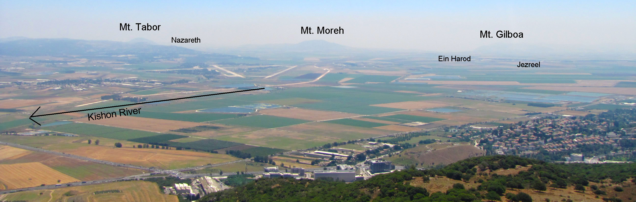


Jezreel Valley
by Galyn Wiemers, Generation Word
Jezreel Valley in the Bible:
Jos.17:16, allotted to the tribe of Manasseh, but the inhabitants had iron chariots;
Jud.6;33-37; 7:1-25, Gideon defeats the Midianites here after camping on Mount Gilboa while the Midianites camped on the Hill of Moreh;
1 Sam.29:1; 31:1-8, Saul was killed on the SE end of the Valley on Mount Gilboa;
1 Kings 4:12, Solomon places three cities of the Jezreel Valley (Beth Shean, Megiddo and Jezreel) under the leadership of Baana;
1 Kings 18:45-19:2, Elijah outrun’s Ahab’s chariot to Jezreel by running across the Jezreel Valley;
2 Kings4:8-37, Elisha raises the Shunammites son back to life in Shunem in the Jezreel Valley; 2 Kings 9:14-37, Jehu kills Joram, Ahaziah and Jezebel in Jezreel in the Valley;
2 Kings 23:29-30, King Josiah is fatally wounded here trying to stop Pharoah Neco from assisting the Assyrian army verse the Babylonians;
Zech.12:11, weeping will be great like the weeping of Hadad Rimmon in the plain of Megiddo;
Luke 7:11-17, Jesus raises the son of a woman from Nain back to life in the Jezreel Valley on the north edge of the Hill of Moreh;
Revelation 16:13-14, 16, the location of a future battle known as Armageddon (Har Megiddo, “Hill of Megiddo”)
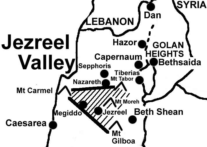
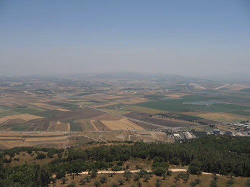
A triangle shaped valley 20 miles long and 14 miles wide on the east end. The International Highway from Egypt to Mesopotamia passed through this V valley and intersected the main raod that fran from the Jordan Valley through Beth Shean to the Mediterranean Sea. Many important cities, mountains and events are located here: Mount Carmel, Mount Gilboa, Mount Tabor, Mount Moreh, Jezreel, Megiddo, Beth Shan, Nain, Nazareth and more.
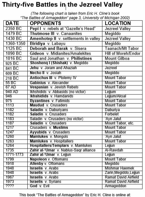
See a list of the great battles of history fought in the Jezreel Valley below.

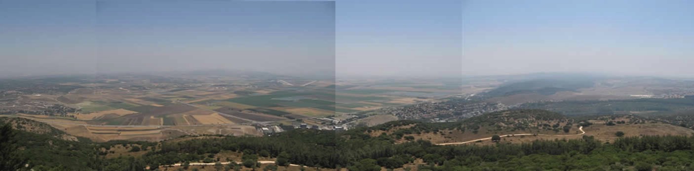
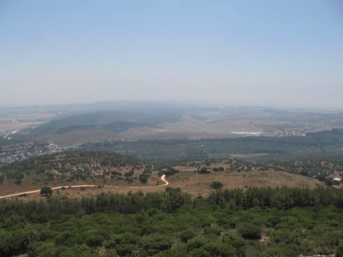
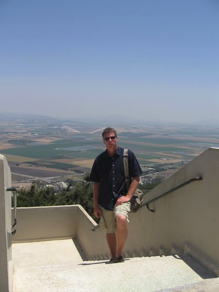
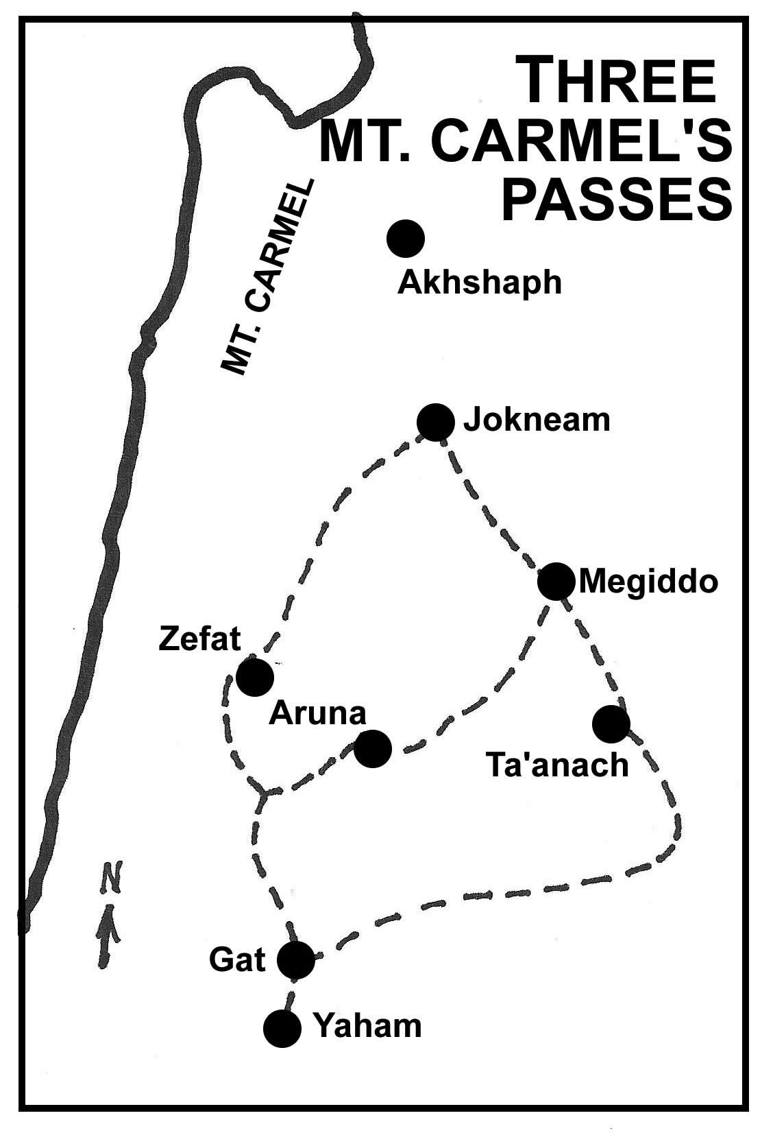
This picture is looking Southeast. There are three routes though these foothills of Mt. Carmel. One is seen along the valley below going off the right side of the photo. The other two are further south. These are the three routes that travels, traders and soldiers would have used through out history. (Notice the dirt road.)
The "V" shape from the two roads to the left middle of the picture is the Israeli air force base.
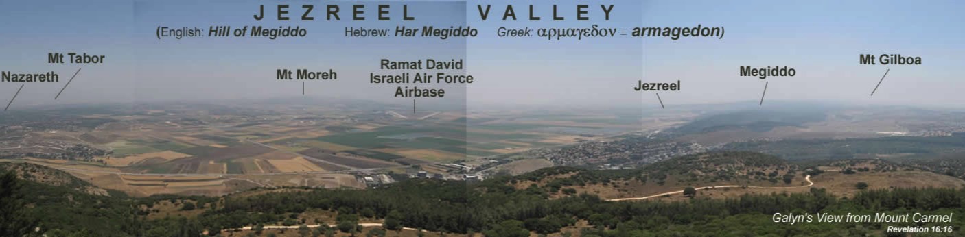
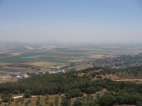
This is the Jezreel Valley. Many of the great battles of history have been fought here. Much of Israel's grain comes from this valley.
The road going to the right off the picture is the main route to the north of Carmel to the Mediterranean coast.

(Or, Armageddon, Har Megiddo, Hill of Megiddo, Valley of Armageddon)
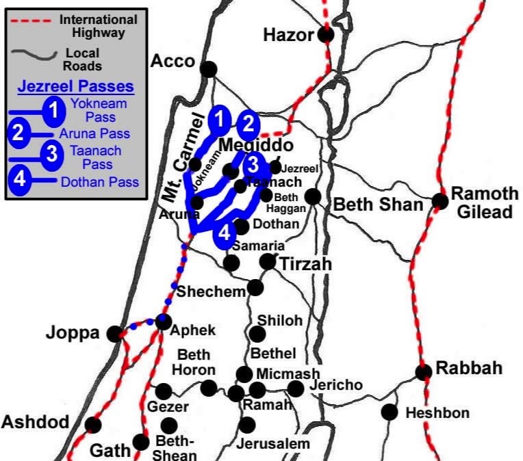
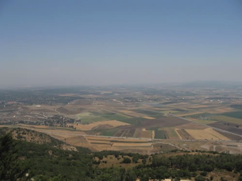
These were (are) used for trade routes and military maneuvers.

Generation Word Provides:

A Bible Teaching Ministry
of Galyn Wiemers