44- Robinson's Arch |
Robinson's Arch is on the south end of the western wall. It supported a staircase that led up to a gate into the Temple Mount.
The arch is named after Edward Robinson, the American scholar who first identified it in 1838. What remains of this arch is
about 39 feet north of the southwest corner of the Temple Mount wall, and it measures about 50 feet long. In 1867 Charles Warren
located the large pier built on the bedrock 41 feet directly west of the arch, which is also 50 feet long. |
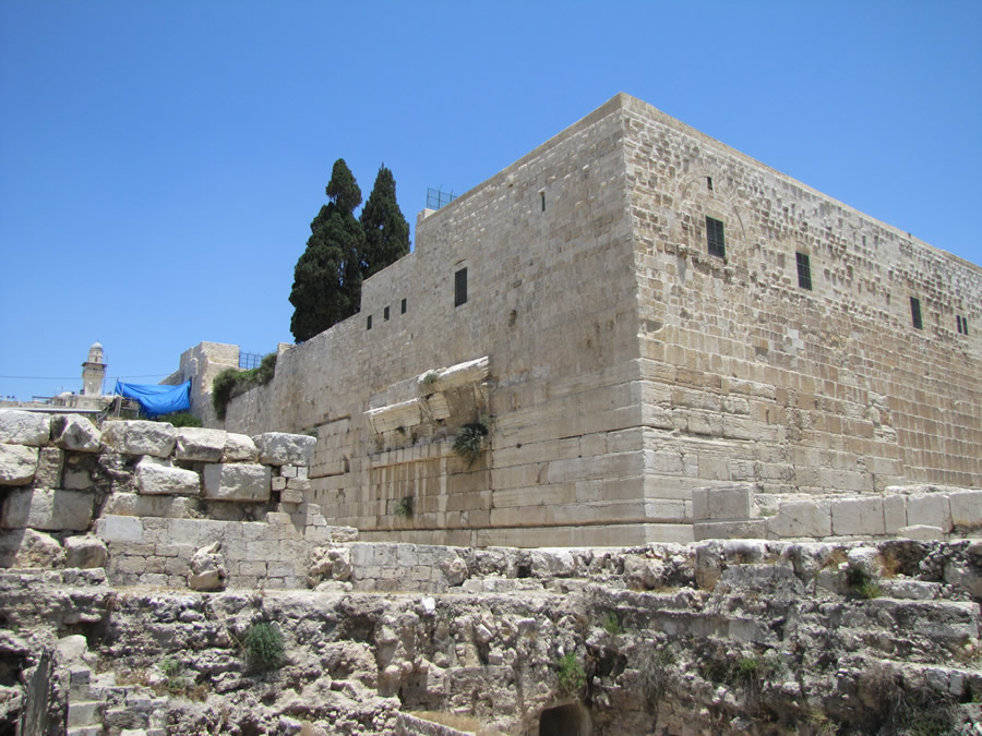
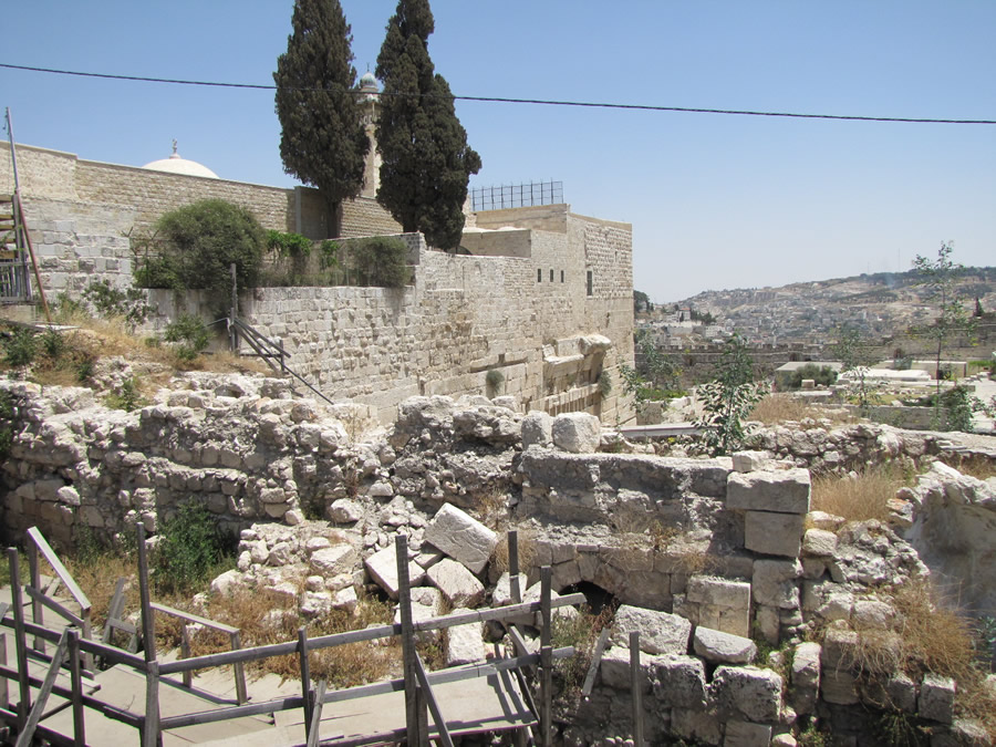
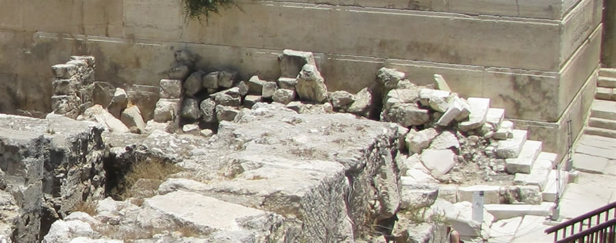
The southwest corner of the Temple Mount. The remains of where Robinson's Arch made contact with the Western Wall can still be seen. The entrance gate
would have been directly above this.
|
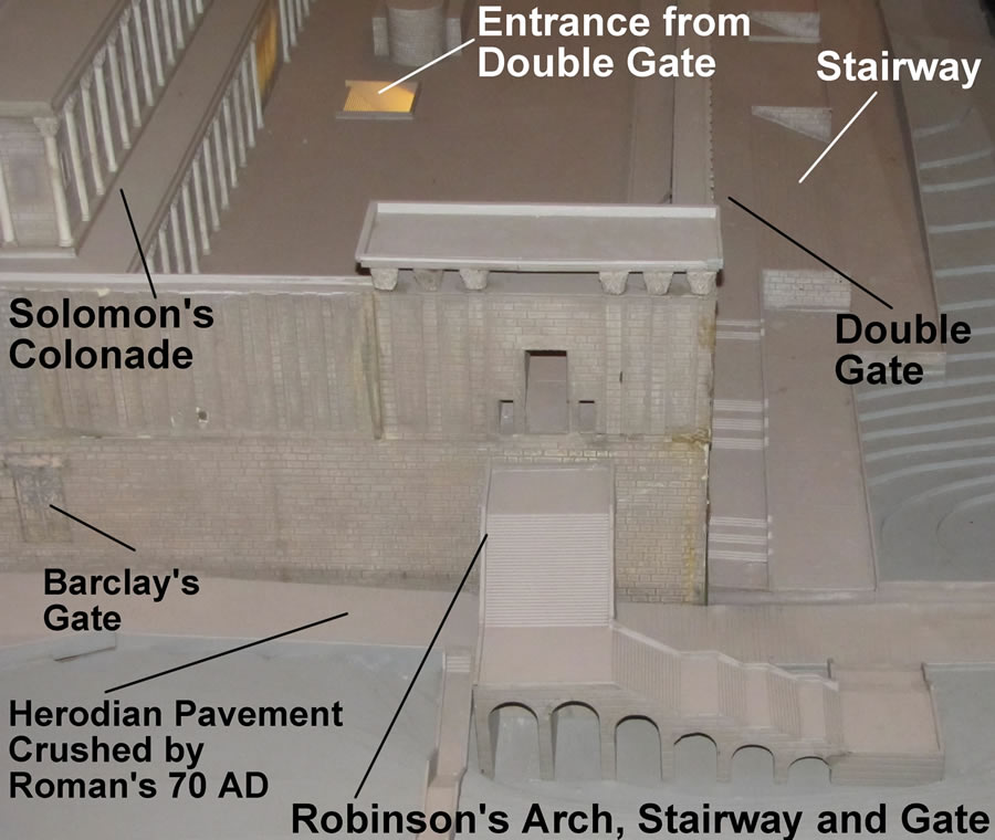
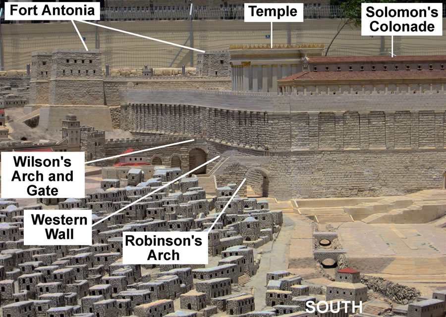
Details of a model showing the southwest corner of the Temple Mount. The staircase leading up to Robinson's Arch can be seen near the middle.
The arches under the stairs were shops. These shops and others along the Western Wall directly under Robinson's Arch and gate have been located
and excavated.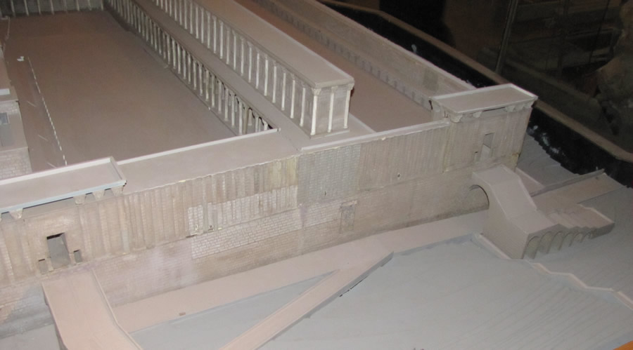
Robinson's Arch - a view of a model from the northwest
|
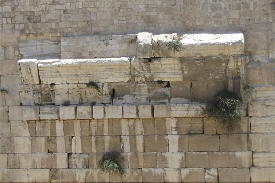
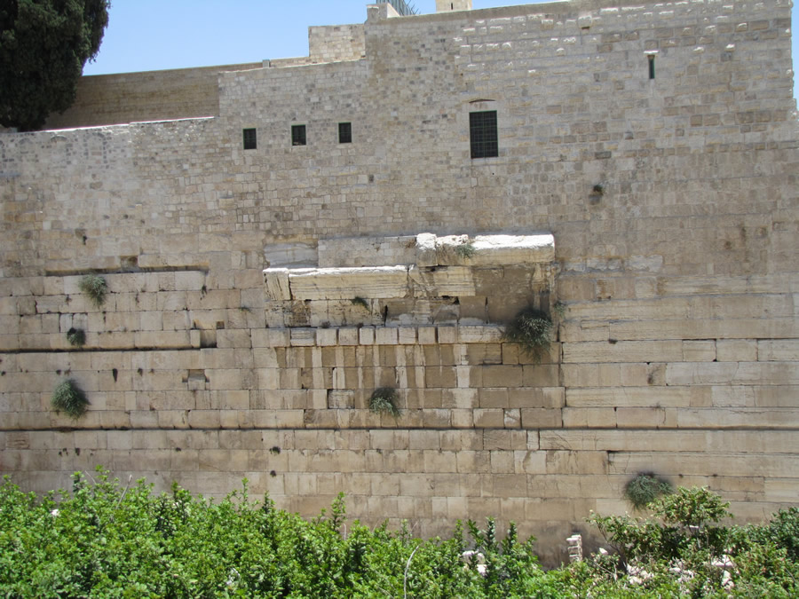
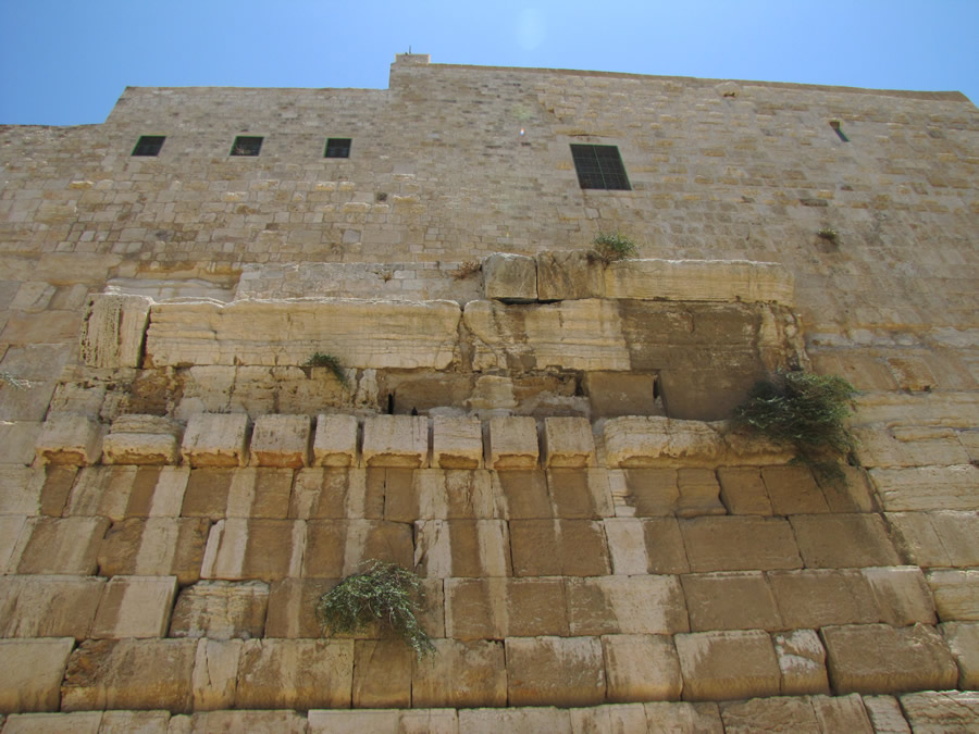
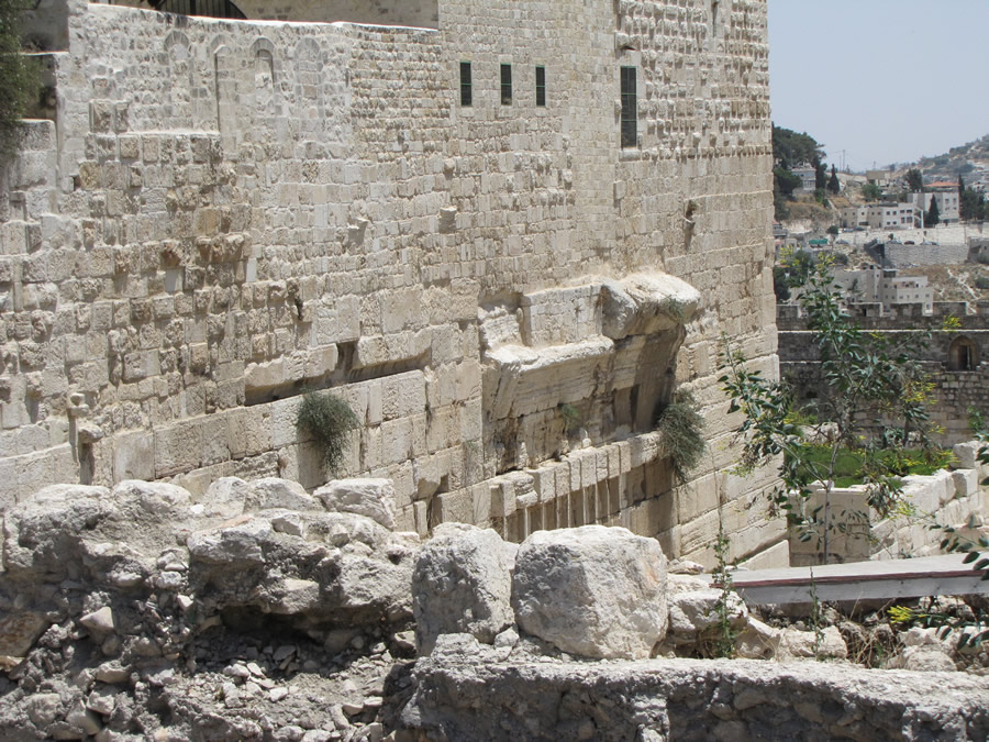
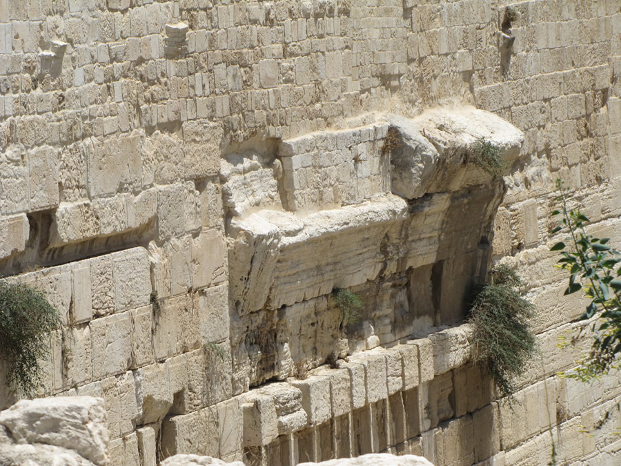
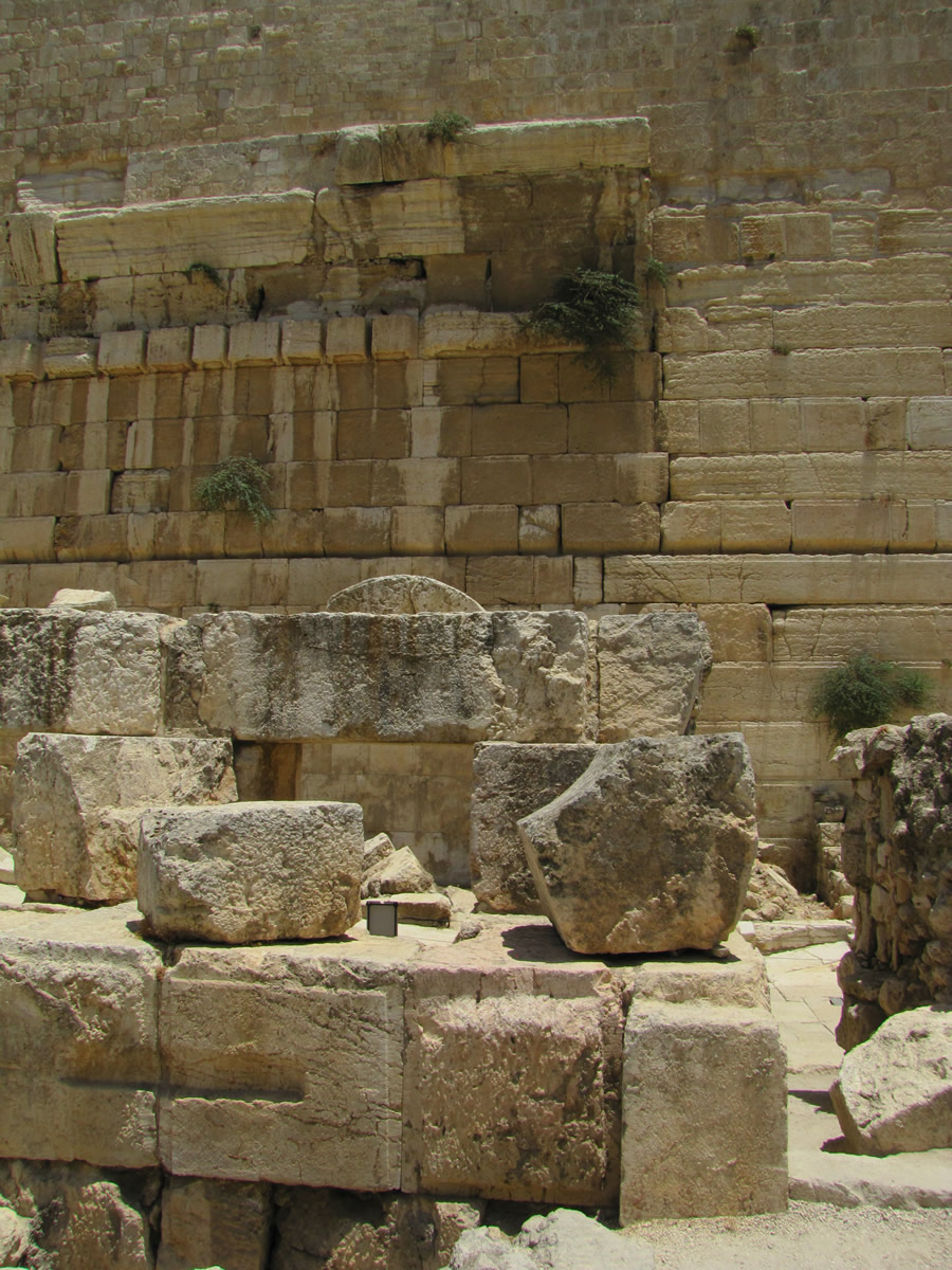
Robinson's Arch - all that remains of this Herodian structure is the spring of the arch which was embedded into the wall to support the arch and pavement. The
gate was designed to provide access to the Temple Mount, directly above this spring (A spring of an arch is the point at which the arch begins to rise from its
support).
|
|
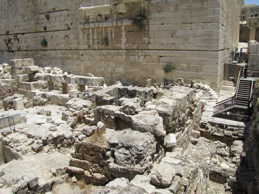
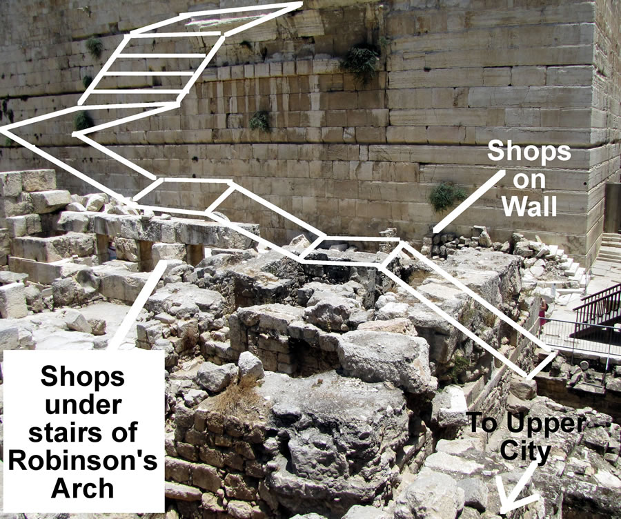
Benjamin Mazar excavated this area after 1967. Before that time the ground level was up to Robinson's Arch so that a person could walk up and touch it. Above, in
the excavation you can see (from left to right):
- The square openings of shops that were under Robinson’s Arch
- The remains of the piers that supported the arch and the staircase
- Steps at the base of the Temple Mount corner that led up to a pavement which ran over the top of the shops that sat under Robinson’s Arch
- Located just to the left of those steps are the remains of walls (3 or 4) from the shops that were perpendicular to and butted up against the west wall (facing the camera),
- The pavement and steps that ran along the south (right) side of the Temple Mount
|
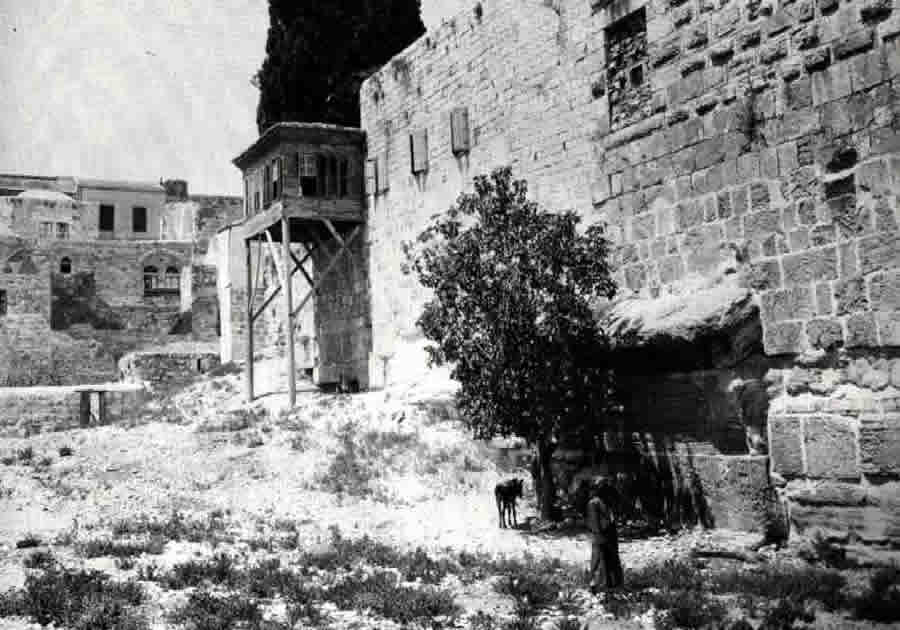
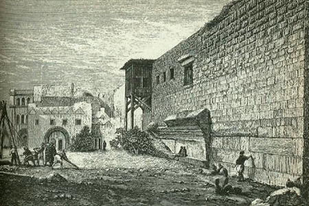
| Below is an early image of Robinson's Arch before excavation. Notice the ground level is very high up on the soiuthwest wall of the Temple Mount |
|
 |
A drawing from the time of Charles Warren in the late 1800's that
shows the the southwest corner of the Temple Mount and includes
Robinson's Arch.
People could walk up and sit on the stringer of this great arch. |
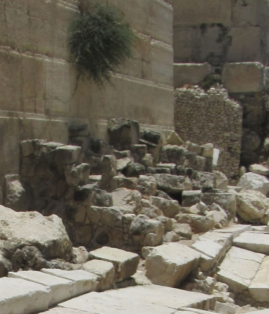
The groove seen along the wall running below Robinson's Arch on both the west and south walls was cut into the Herodian ashlars by the Muslim
Umayyad Dynasty between the years 651 and 750. The Muslims used these grooves to hold pipes that supplied water to the buildings constructed to the
south of the Temple Mount. The walls of one of those buildings can be seen in the right of this photo directly behind the Temple Mount’s southern wall. A close look at the walls of this building reveal that it was built with reused Herodian ashlar stones that were left from the Roman destruction of the Temple site in 70 AD. Reused Herodian ashlars are very common throughout the city.
|
A view looking up at Robinson's Arch from the original Herodian pavement below. The blocks and windows above the arch are not original. The windows open into
the Islamic Museum that can be visited on the Temple Mount. The Muslims call the Temple Mount Hara mesh-Sherif, “The Noble Sanctuary.” This arch, the
spring, and all the stones in the wall below the arch are original from the Days of Herod's construction, which began in 19 BC. The arch, the staircase, and the gate
were in use in the days of Jesus when he spent time on the Temple Mount.
|
Toni sits on the curb of the street that ran under Robinson's Arch in 30 AD. There are shops behind Toni and across the street from her under Robinson's Arch. Robinson's arch can be seen across the street from Toni. Rubble from the Temple's destruction in 70 AD lays were it fell on the crushed pavement stones.
This photo presents a perspective of how high Robinson's Arch was from the street and shops below.
|
A view of the southwest end of the Western Wall with Robinson's Arch.
|
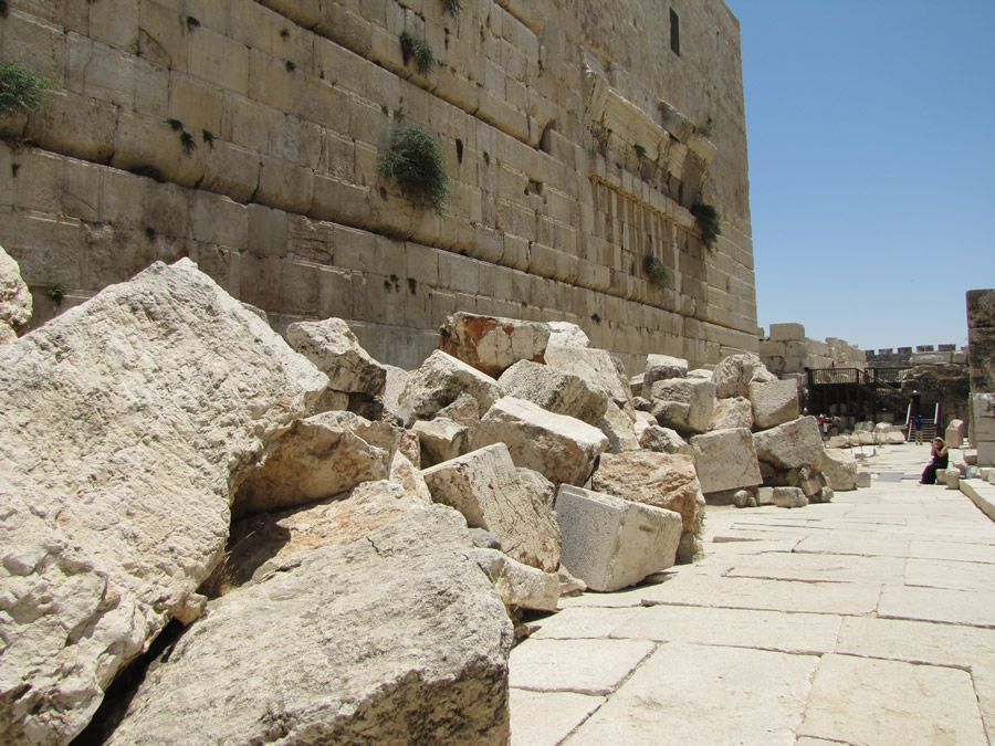
A photo taken from on top of rubble that has not yet been removed looking south at Robinson's Arch. Until 1967 the rubble under Robinson’s Arch brought the
ground level up to the arch. Older photos of Robinson’s Arch show people touching and sitting on the Arch from ground level.
|
This close-up shows the Herodian ashlar stones that surround the arch.
|

The southern wall of the city can be seen in the background. On the other side of the city wall is the ancient City of David which can not be seen since
the city is lower. The hill in the the back ground is south of Jerusalem. |
| |
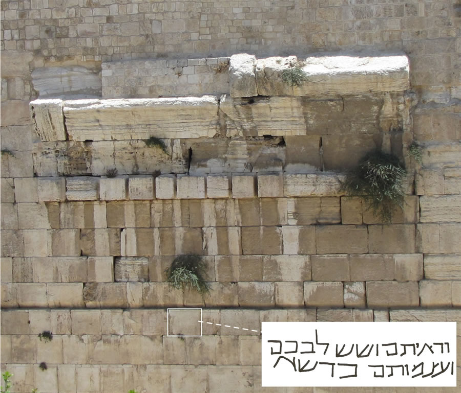
A Hebrew inscription was engraved and is visible in one of the ashlar blocks under Robinson's Arch.
"You shall see and your heart shall rejoice. Their bones shall flourish like grass."
|
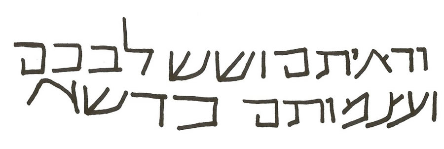
The inscription may have been engraved around 900 AD to commemorate the Jewish graves found in the rubble under the arch from that same time period.
The inscription comes from Isaiah 66:14. This inscription was discovered by Benjamin Mazar during his excavations that began after the Six-Day war
in 1967. The inscription reads:
You shall see and your heart shall rejoice. Their bones shall flourish like grass.
It appears to be a paraphrase of Isaiah 66:14:
When you see this, your heart will rejoice and you will flourish like grass.
Mazar believes this inscription was placed here on the west wall of the Temple Mount by the Jews who were allowed back into the city to rebuild the Temple
in Emperor Julian’s day in 363. Others recognize that about four feet below the inscription 30-40 burials had taken place around 900 AD. |
| |
Shops were located on both sides of the street. Some where against the Temple Mount wall under Robinson's Arch. Other shops were under
the stairway that led up to Robinson's arch.
|
The remains of one of the shops whose walls also served as support for the staircase that led up to Robinson's Arch.
|
Shops under Robinson's Arch that were built up against the Western Wall. The pavement and the curb of the street that ran under Robinson's Arch
can be seen in the bottom of this photo.
|
Here the remains of the walls of the shops under Robinson's Arch can be seen. Notice to the right, at the southwest corner of the Temple Mount wall, the remains of steps that went up and over the tops of the shops.
|
A model showing the view of Robinson's Arch from the southwest. |
| |
| |
| |
| |
| |
| |
| |
| |
|