Section E New Testament
Chapter 45 - Western Wall Street
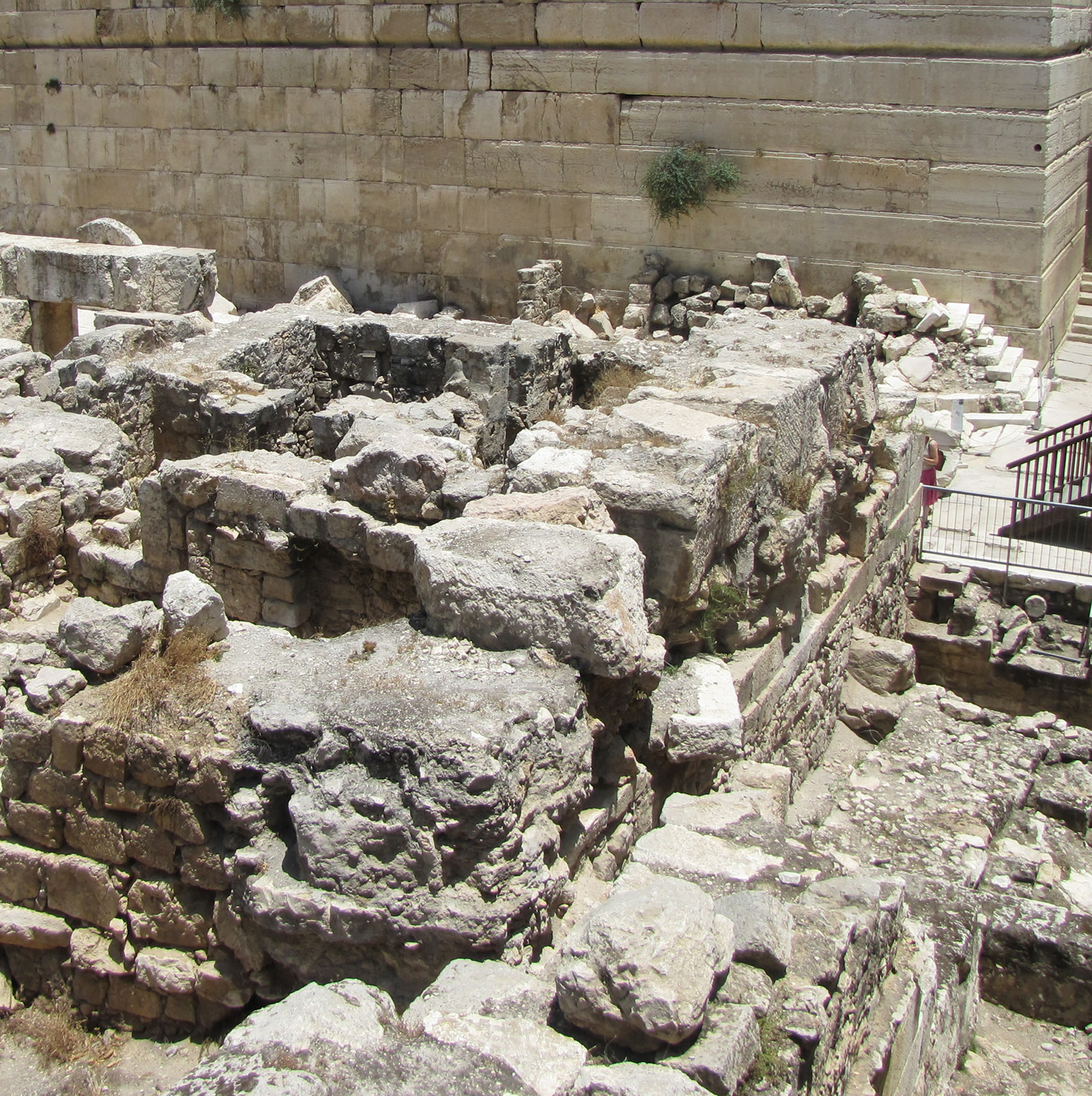
A Herodian street from the days of Jesus and the New Testament runs along the west side of the Western Wall. A portion of this street has been found at the northwest edge of the Western Wall inside the tunnels (as seen in a photo earlier in the book). This same street ran from the northwest corner all along the Western Wall of the Temple Mount to the southwest corner (see photo below). It then continued all the way down through the City of David to the Pool of Siloam, where a large portion of it has been excavated. The street was originally built by Herod the Great and later repaved by Herod Agrippa I around 40-44 AD. Under the street is a gutter that is large enough to walk in, which collected rain water and ran it south, out of the city. The pavement is supported by three rows of vaults which created vaulted rooms built on the bedrock. During the Roman destruction of the Temple and Temple Mount huge chunks of rock and ashlar stones were pushed over the edge onto this pavement, where the force of the falling objects crushed portions of the pavement down into the gutter beneath the streets. During the excavation process much of this rubble was removed, but some was left to help communicate the magnitude of the devastation caused by the Roman Legions. The stones that were left in place can still be seen lying on the street in the piles where they landed almost 2,000 years ago.
A 246 foot portion of the street was excavated below Robinson’s Arch. The street there is 28 feet wide and is bordered with raised curbstones.
Looking south down the Herodian street along the Western Wall at the southwest end of the Temple Mount. Notice the flat paving stones used in the street. Notice also the straight stone curb running along the right side. Toni sits toward the end of the street on the curb in front of shops that were under the staircase of Robinson’s Arch. Stones from the Jewish Temple and broken Herodian ashlars lay at the base of the Temple Mount wall right were they landed in 70 AD when the Tenth Roman Legion destroyed the temple and its courts.
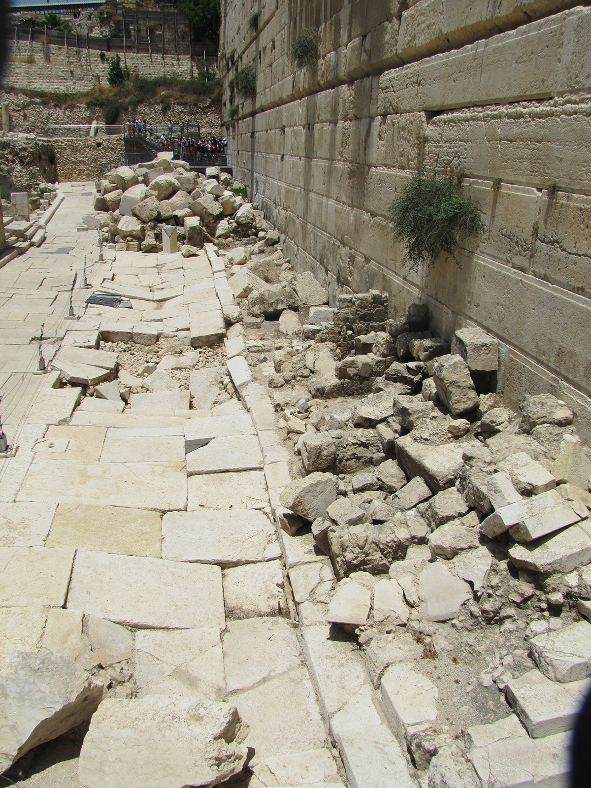
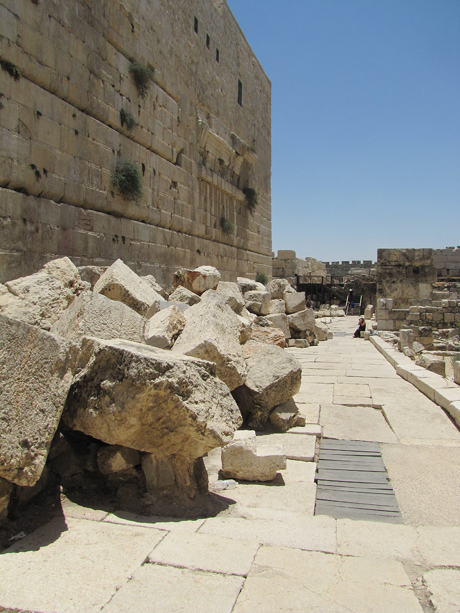
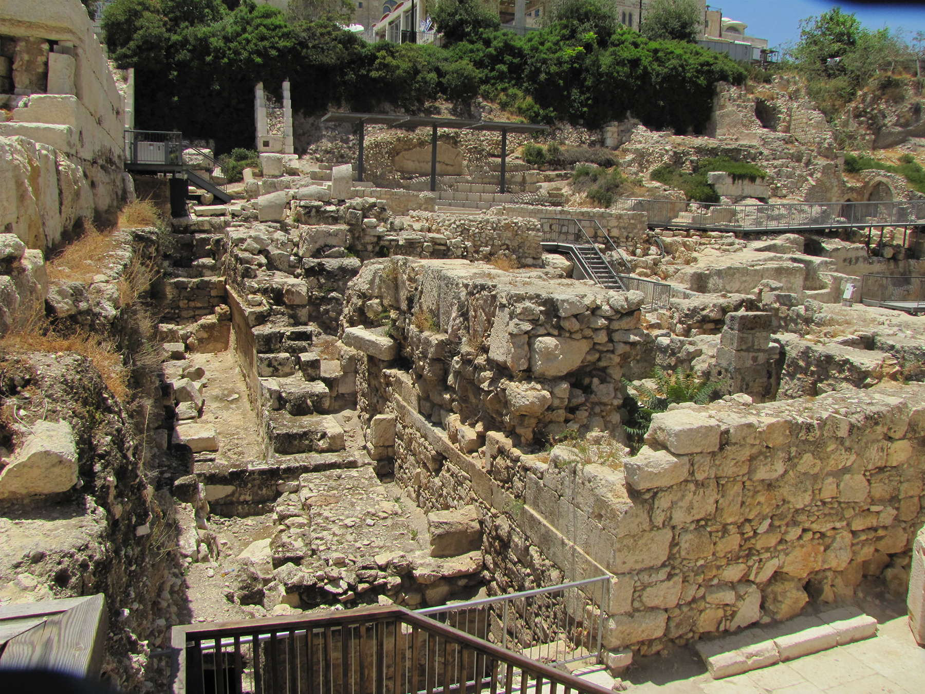
This photo, looking north with the Western Wall on the right, shows the pavement crushed by falling blocks of stone from the Roman destruction in 70 AD. In the bottom right quadrant of the photo the remains of shops built against the Western Wall can be seen. Shops lined both sides of this street and may have been controlled by the High Priest Annas.
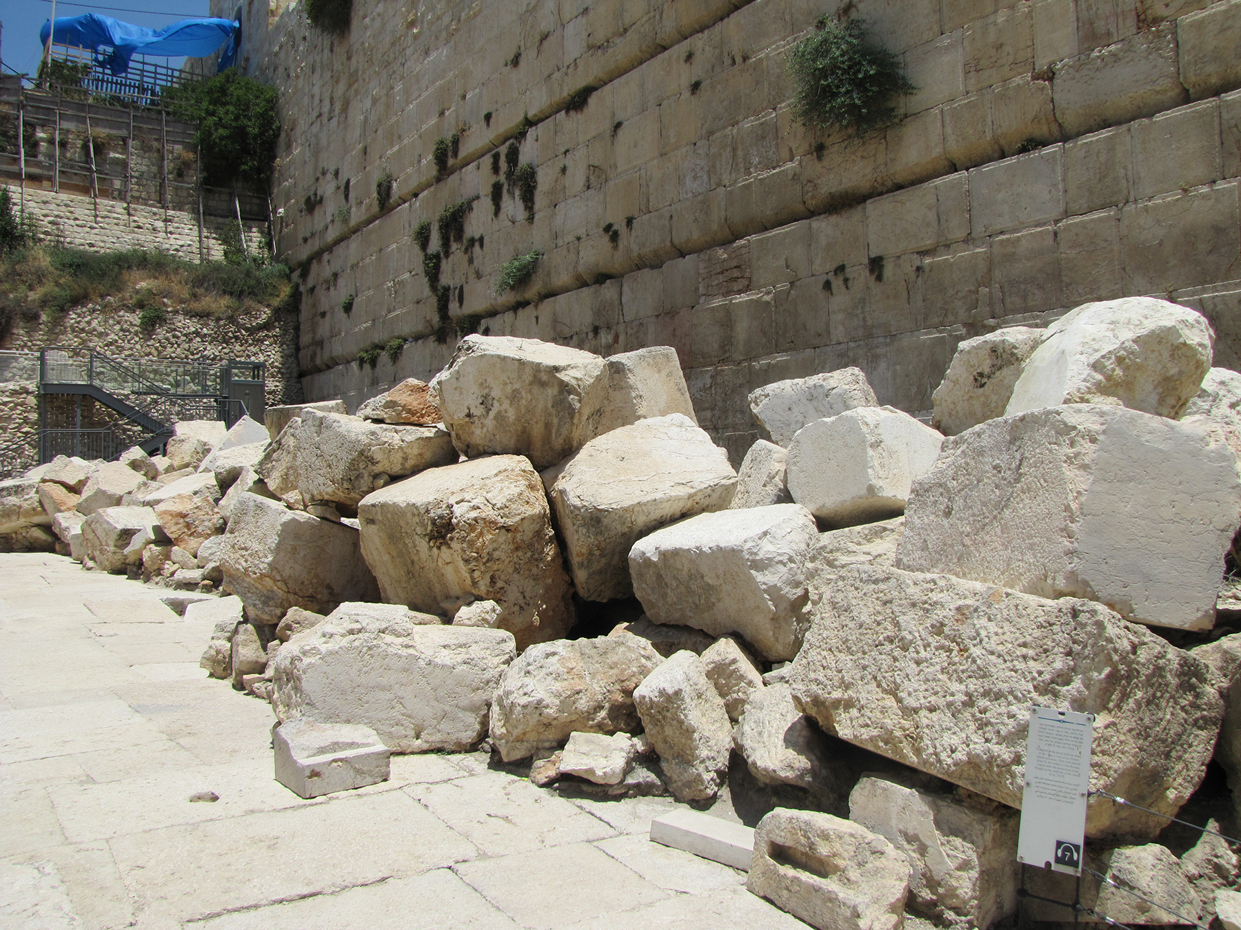
Fallen stones from the Temple and Temple Mount lay in a heap at the base of the Western Wall. At the back left of the photo is an area that has not been excavated. Behind that is the Western Wall Plaza.
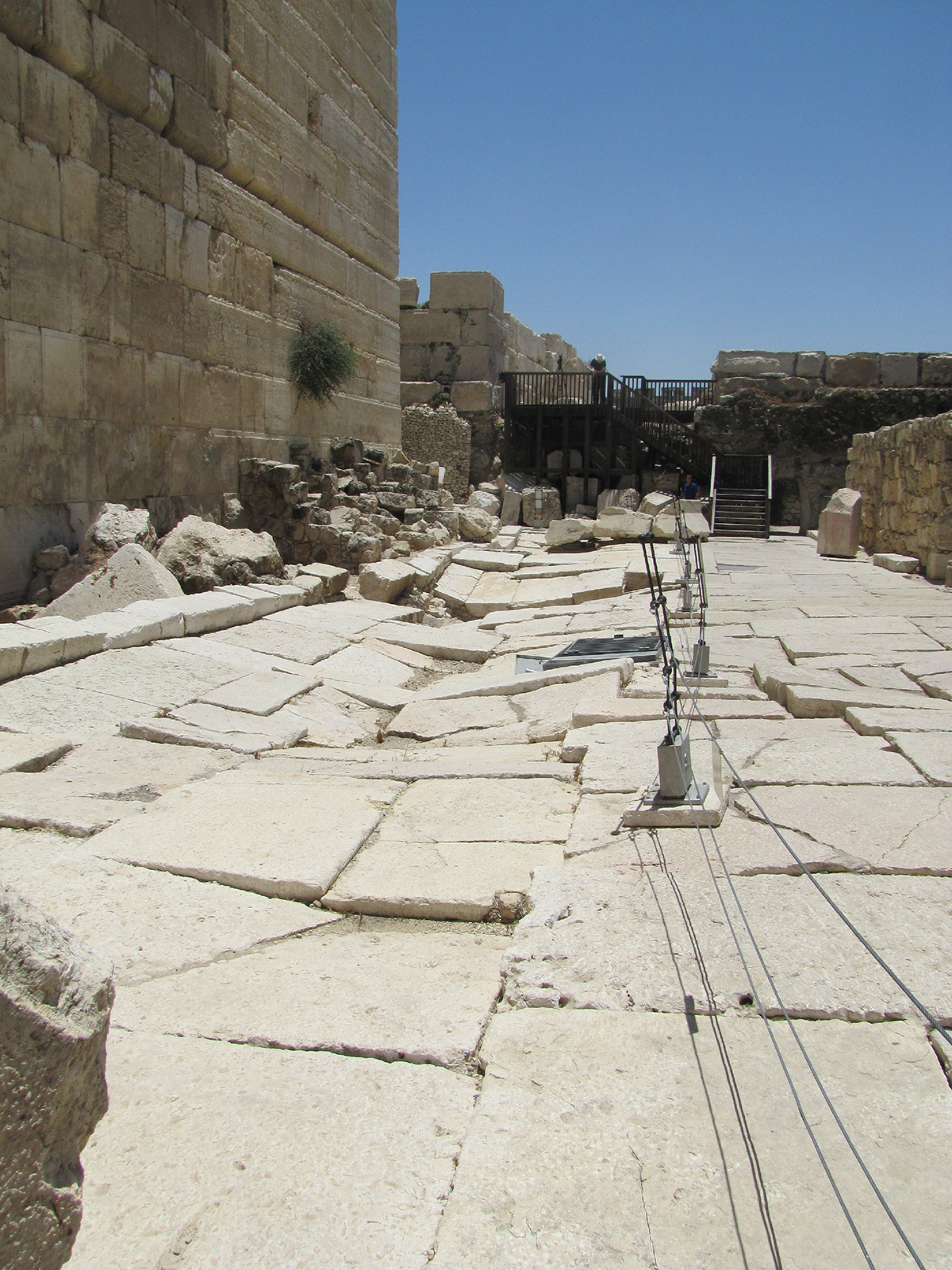
The damaged pavement of the street is seen as we look south. To the right are the shops that were under Robinson’s Arch, and a decorated piece of stone that hurled from the Temple complex above (top right). To the left we see the curb of the street and the remains of the walls of the shops near the southwest corner. To the south are a couple of Muslim buildings constructed during the Umayyad Dynasty from 661 to 750 AD. To the back left is the Umayyad palace. To the back right is the Umayyad hostel. Both of these buildings were made of Herodian ashlar found in the Roman rubble.
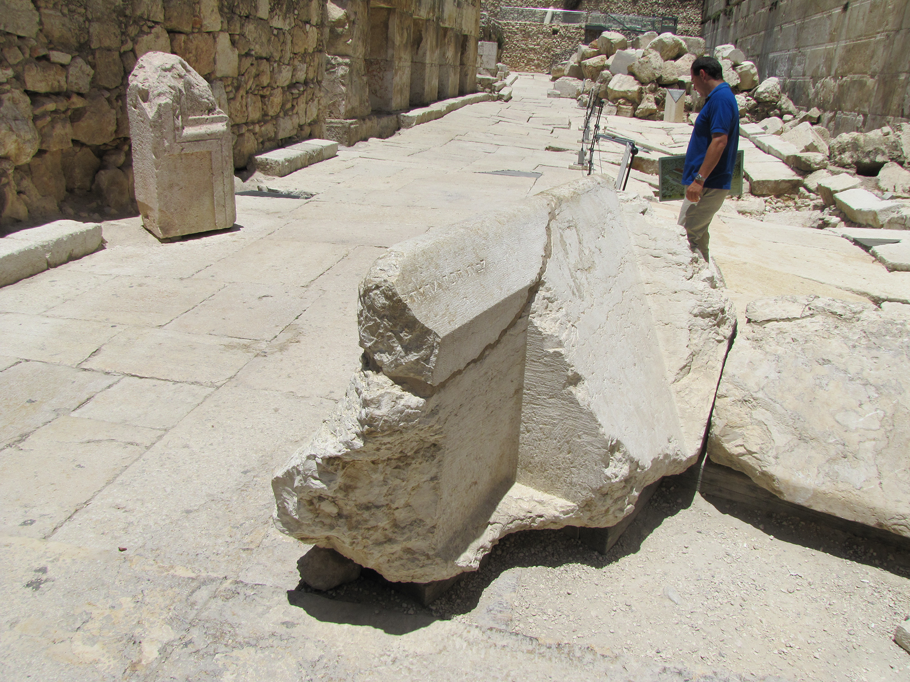
Two interesting pieces of the Temple complex are seen here. 1) In the front right is a stone that fell from the Temple Mount above. It is a piece of the railing from the course of stones at the top of the southwest corner, and is called the Trumpeting Stone. The priestly trumpeter would have stood on this stone to sound the trumpet signaling the beginning and end of Sabbath days and festivals. The sharp corner that has been cut out of this block is where the priest would have stood, and the beveled edge served as a guard railing. In the top left portion of the guard rail is a Hebrew inscription. It is likely that James, the pastor of the Jerusalem church who wrote the book of James, was forced to stand on this stone in 63 AD to proclaim that Jesus was not the Messiah. Instead, James confessed Jesus by announcing to the crowd that Jesus was the Christ, that he sits at God’s right hand, and that he will return in the clouds from heaven. The scribes and Pharisees responded by pushing James, the brother of the Lord, over this railing to his death. 2) Behind the Trumpeting Stone on the pavement is a nicely carved block that was a decorative piece from the Temple complex. Also notice the four shops on the curb of the pavement on the left side, at the back of the photo.
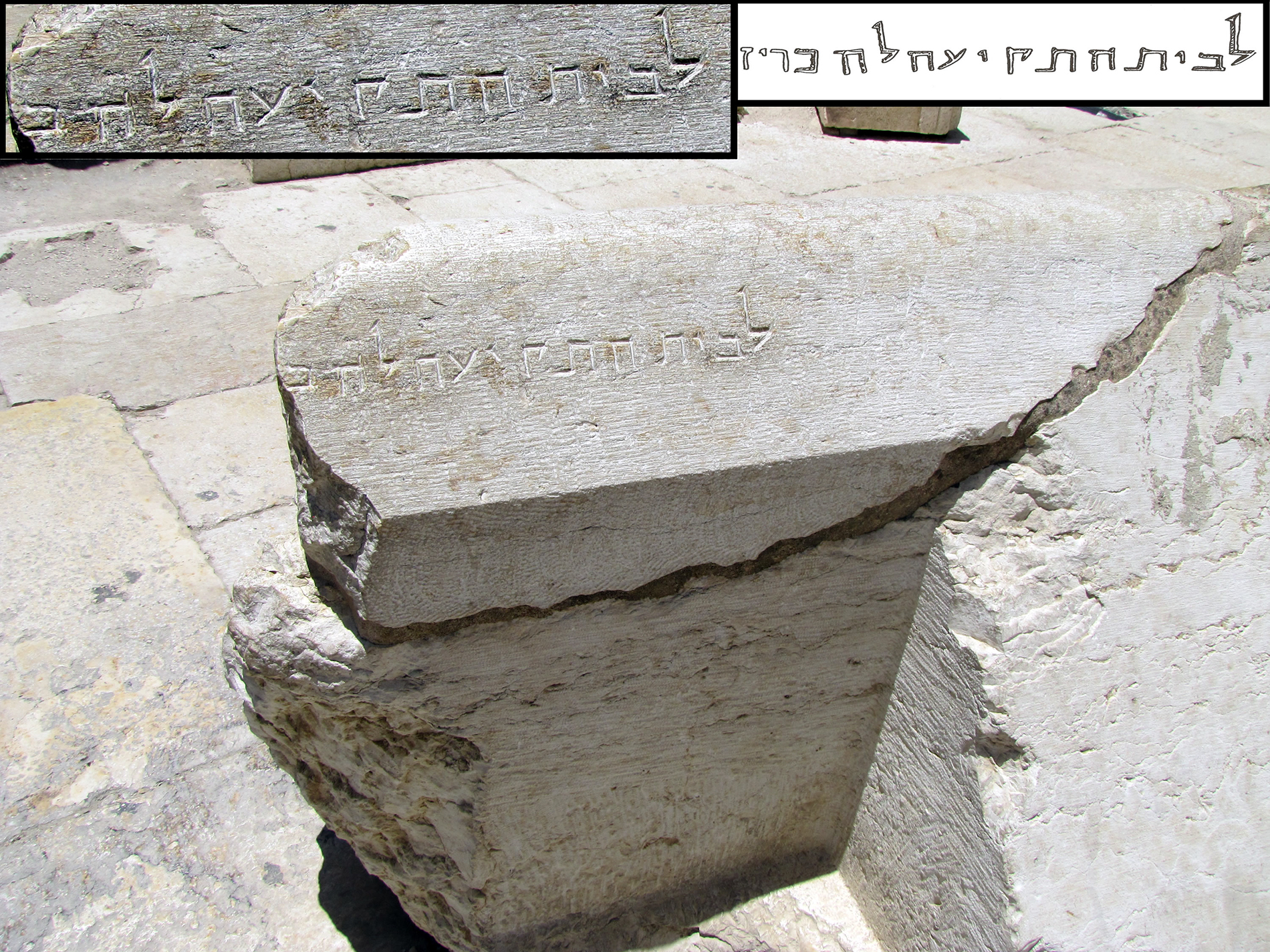
A close up of the Trumpeting Stone that was found directly under the southwest corner. The Hebrew inscription can be clearly seen on the railing. It is read right to left, and says: “For the place of trumpeting to . . .” It appears the rest of the inscription was broken off when Charles Warren dug a tunnel through the rubble in the 1800’s, and went right through this stone. The rest of the inscription may have said “For the place of trumpeting ‘to the temple,’ or, ‘to herald the Sabbath.’ Above the roof of the priests’ chambers, . . . it was the custom for one of the priests to stand and to give notice, by sound of trumpet, in the afternoon of the approach, and on the following evening of the close, of every seventh day, announcing to the people the respective hours for ceasing work and for resuming their labors. - Josephus IV:9:12
Josephus describes this place on the Temple Mount wall when he writes:
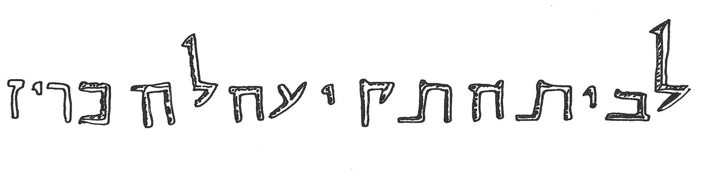
The Hebrew inscription on the Trumpeting Stone from the Temple that Herod built.
This view is looking at the back of the shops (see the lintel of the shop door, middle left) and at the southwest corner of the Temple Mount. In the middle of the photo is a bakery where circular floor ovens were found.
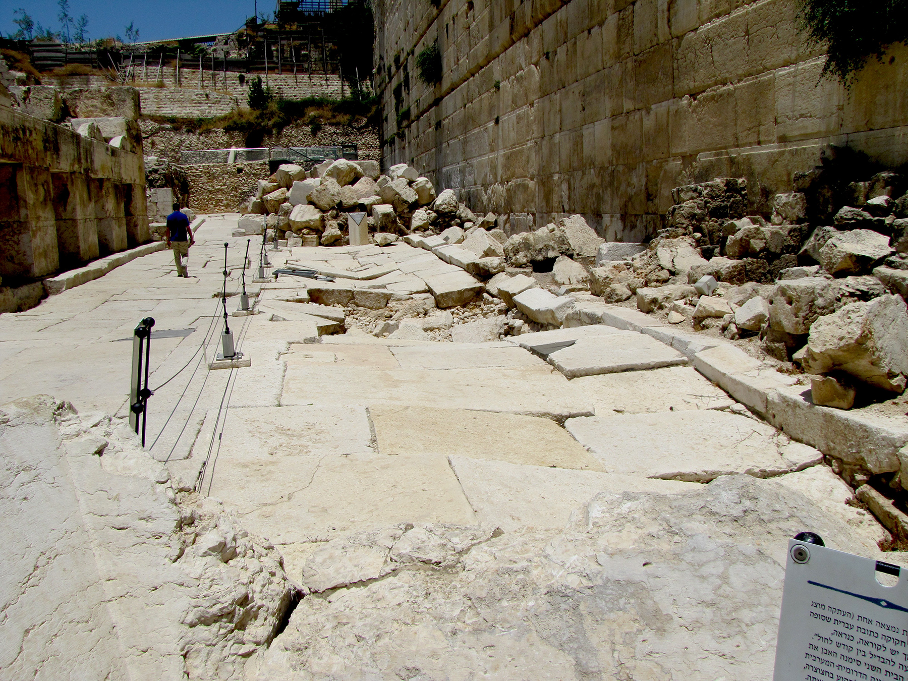
Looking north over the Trumpeting Stone (in the forefront of the photo) at the pavement along the Western Wall. The curbs on both sides of the Herodian pavement are visible, as well as four shops on the west side (left) of the street. The ruins of shops on the east side (right) that sat against the Western Wall can also be seen. The full width of the street is recognizable even though the right side is crushed and rubble remains on the street in the background.
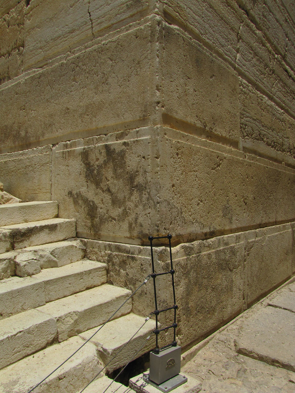
This photo shows the southwest corner of the Temple Mount wall. The Herodian ashlar cornerstones are clearly visible. To the right (east) are the pavement and steps that lead along the southern wall. To the left (going north) are the stair steps that led up to the top of the shops that sat along the Western Wall.
This is the front view of the same bakery. Notice the three blocks of the curb and the pavement in front of the bakery, in the bottom right corner of the photo.
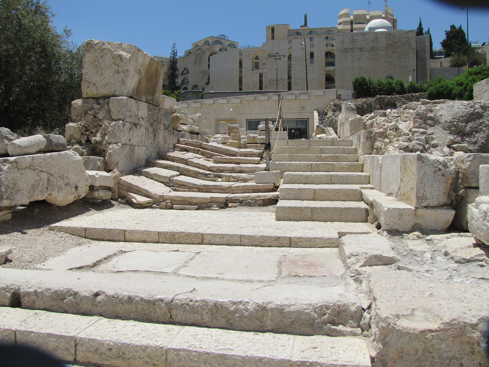
This photo was taken from the southwest corner of the Temple Mount looking west toward the Western Hill (Western Ridge) where the Upper City was located in the first century. The remains of the stairs and pavement that led people back and forth from the Temple to the Upper City still remain. The base, or pier, of Robinson’s Arch is on the right.
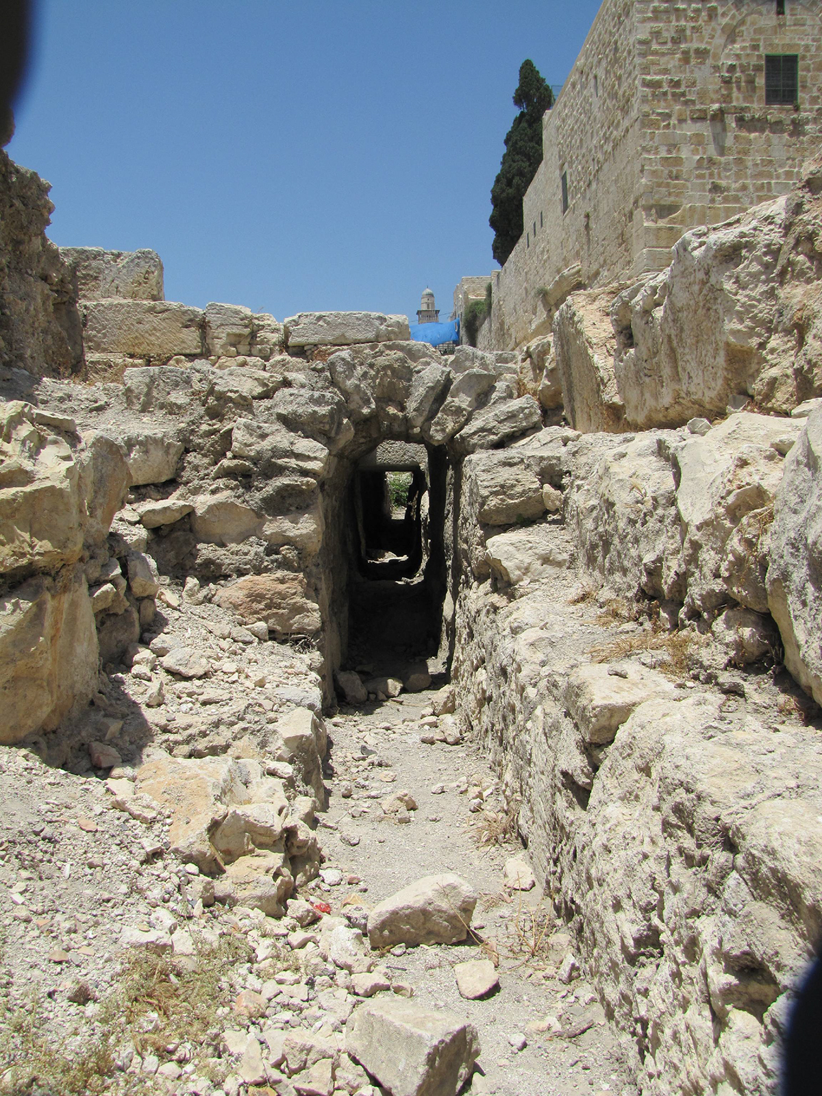
A covered channel runs north-south along the Western Wall. The southwest corner of the Temple Mount is in the top right-hand corner of the photo.