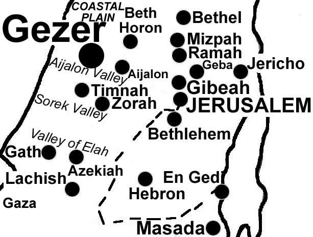
Located on the northern edge of the Shephelah. It was strategically positioned at a junction on the international coastal highway and the road into Jerusalem through the Aijalon Valley. Thutmose III (1477 BC, Moses step-brother) destroyed the Canaanite city with fire. The Tell Amarna letters from the 1300’s BC include 10 letters from the kings of Gezer to the Egyptian pharaoh.
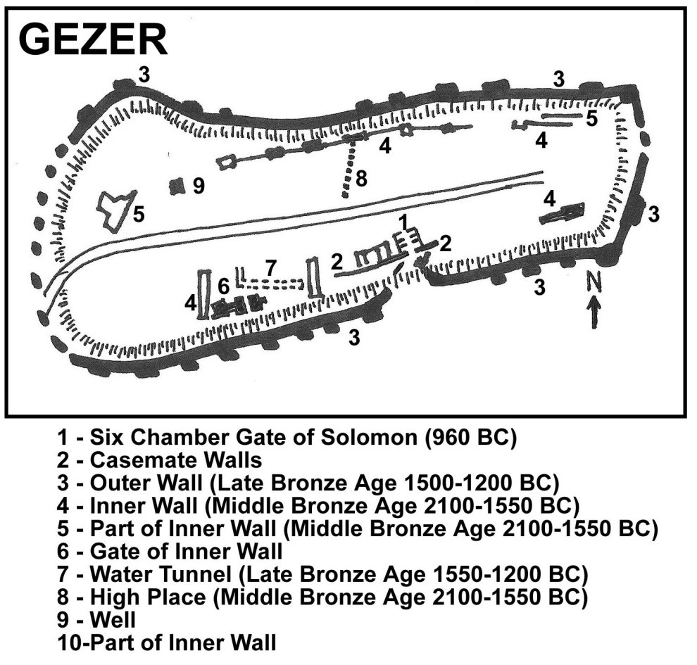
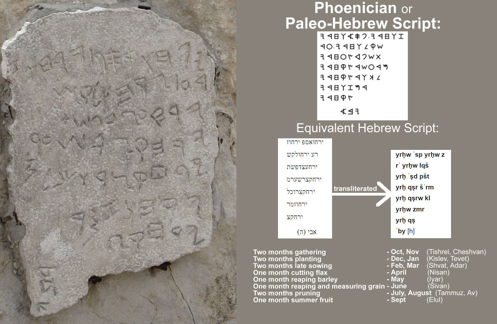
Gezer, but the Canaanites continued to live in Gezer. Around 980 BC the Egyptians destroyed Gezer and the Pharaoh gave it to King Solomon as a wedding gift. (I Kings 9:16) Solomon then rebuilt the city. In 924 BC Shishak fought Rehoboam and destroyed Gezer. (1 Kings 14:25) Archaeology began in the early 1900’s and Gezer has been extensively excavated. The Gezer calendar, a plaque with a text listing the months and the agricultural seasons, was found here. Solomon’s wall and gateway were identified by Yigael Yadin. Also uncovered and sound be seen are:
- the 23 foot diameter Canaanite Water Shaft slanting for 150 feet to connect a spring with the city from 1800 BC and similar to Warren’s Shaft,
- a 52 foot wide tower with its large defensive wall,
- a middle bronze age gate (constructed about 1650 BC) connected to a 13 foot wide wall with at least 25 towers (destroyed by Thutmose III)
- eight monumental megaliths.
- Nine inscribed boundary stones
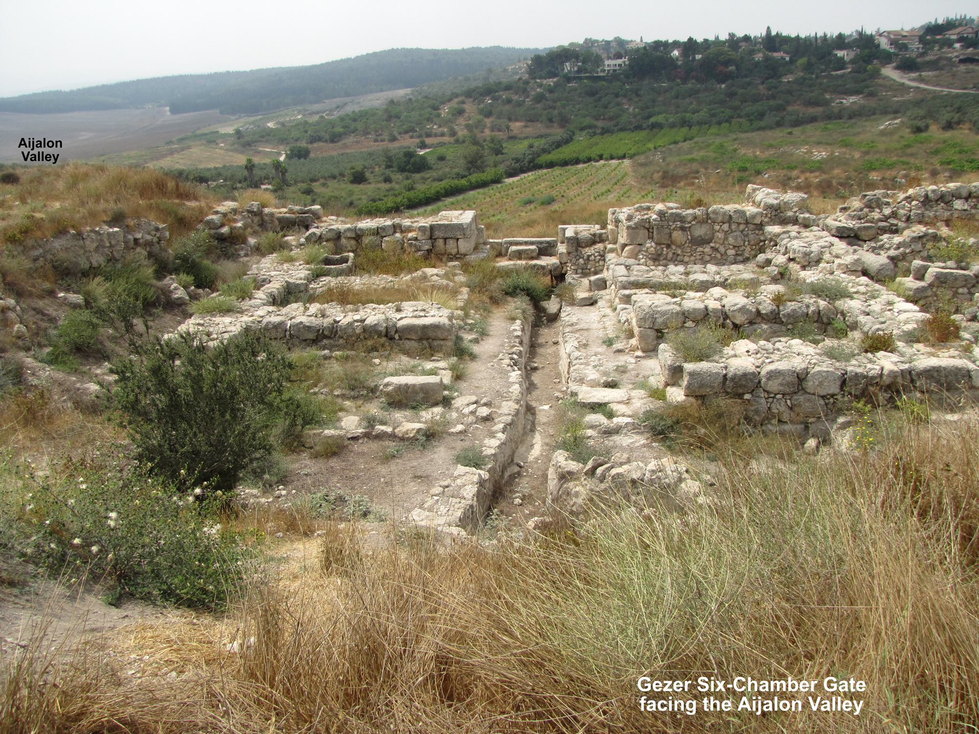
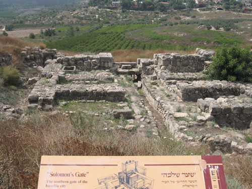
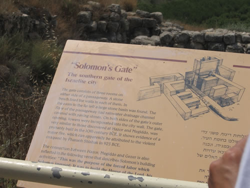
- Solomon’s Six Chambered Gate
#1 - Solomon's Six-chamber Gate of Gezer
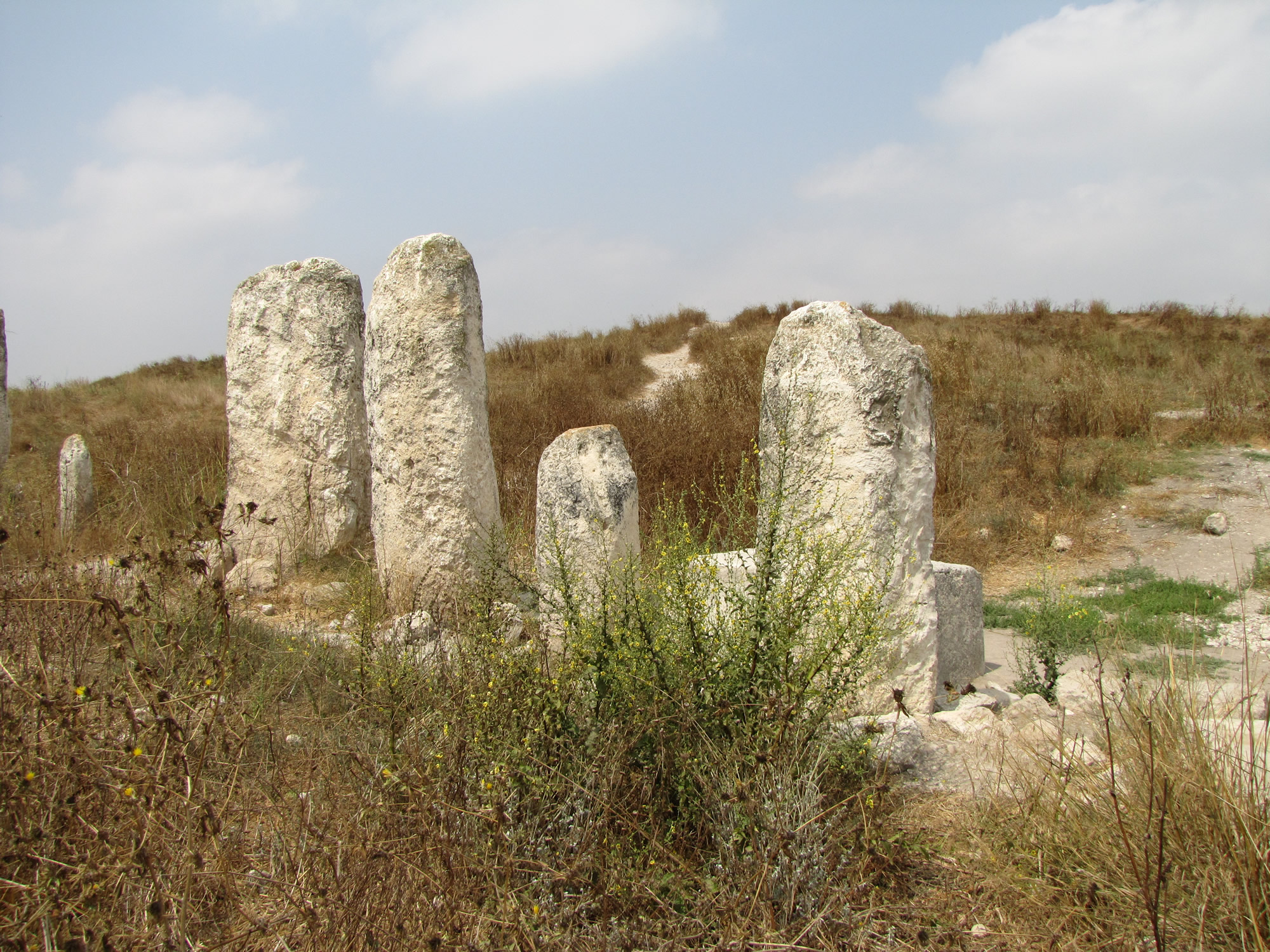
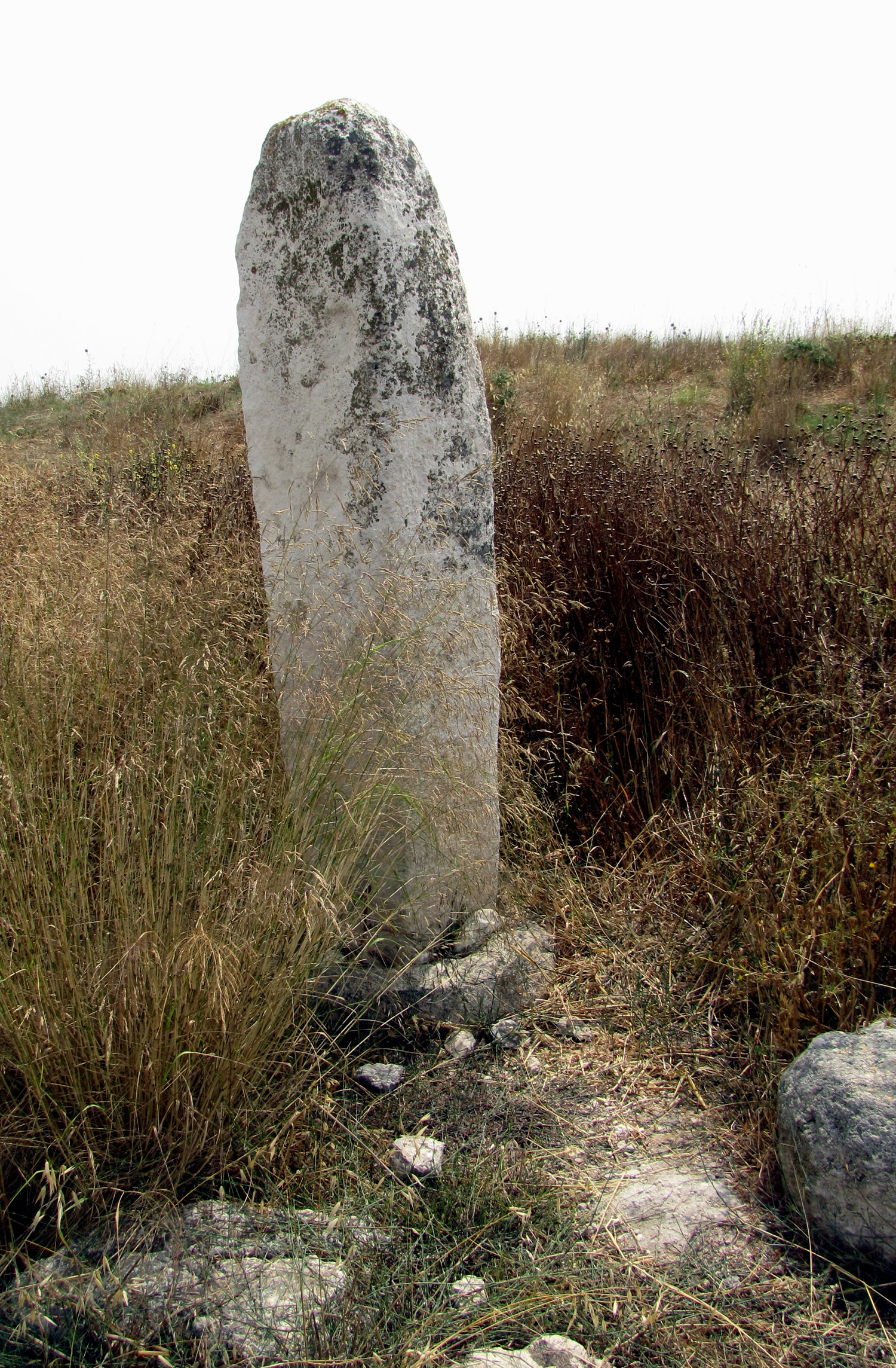
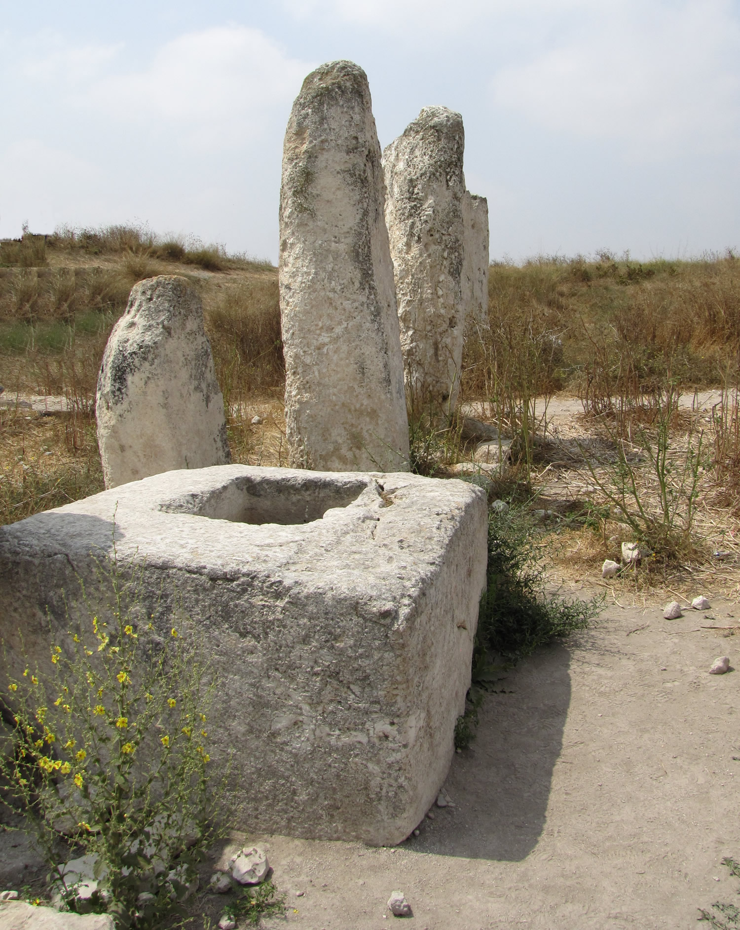
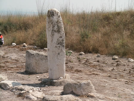
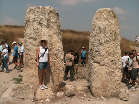
#8 - High Place of Gezer with 10 standing stones (massebot) with a covenant holding box.
A covenant was made here (or, renewed here) and each stone represents a nation, a people, a tribe or a deity.
Some of the stones are over 10 feet tall. This is from the Middle Bronze Age (1500-1200 BC)
Front side of standing stone ceremony center High Place
Back side of standing stone ceremony center High Place
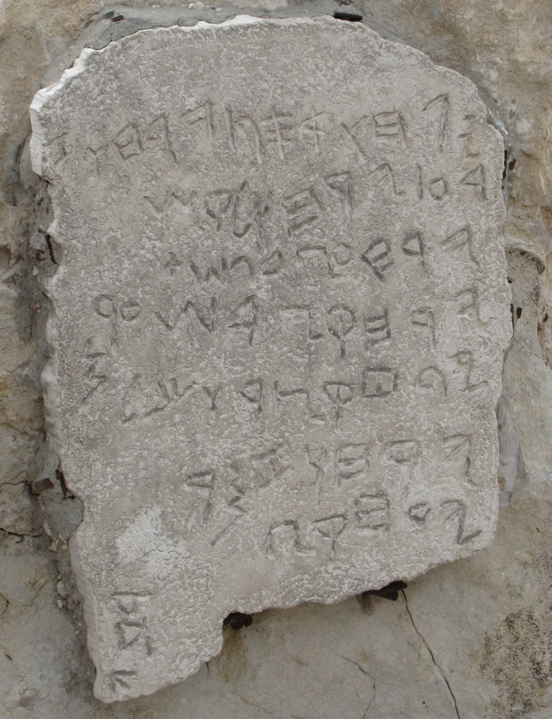
Gezer Calendar - a limestone tablet dixcovered in 1908 from the time of the Canaanites written around 925 BC
Some think it was a poem used for young students to practice their writing skills
It is about 5 x 3 inches.
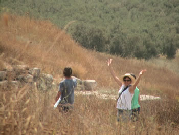
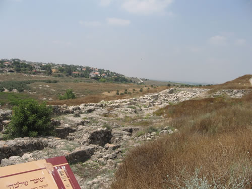
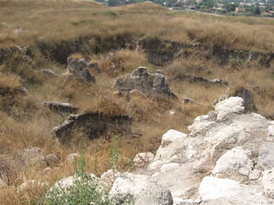
Climbing the hill that is the remains of the Old Testament city of Gezer.
In Solomon's day "Pharaoh king of Egypt had attacked and captured Gezer. He had set it on fire. He killed its Canaanite inhabitants and then gave it as a wedding gift to his daughter, Solomon's wife. And Solomon rebuilt Gezer."
1 Kings9:16-17
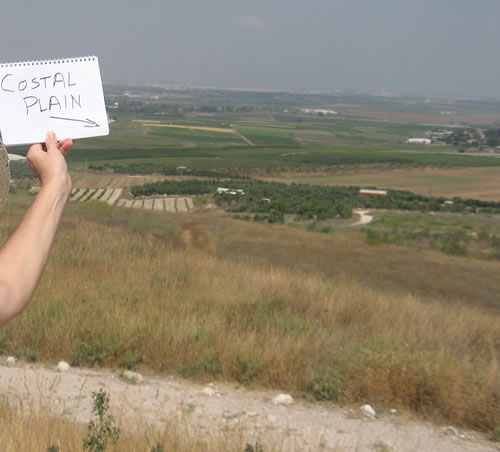
To the west of Gezer the Costal Plain runs along the Mediterranean Coast. This was the main highway for trade, travelers and, most important, the famous military campaigns of the ancient world.
Tel Aviv is in the distance.
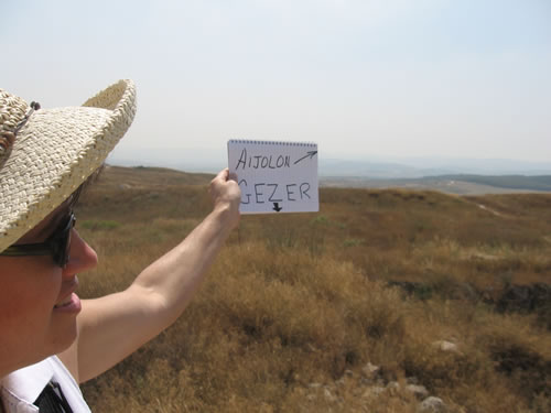
To the east is the Aijalon Valley and the city of Aijalon.
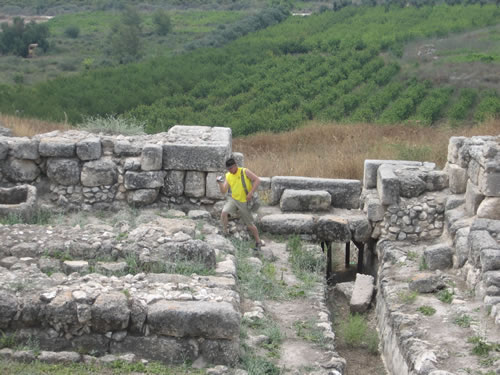
Toni walking on a trail on top of the tel of Gezer that leads down to the famous city gate built by Solomon.
"Here is the account of the forced labor King Solomon conscripted to build the Lord's temple, the wall of Jerusalem, and Hazor, Meggido and Gezer." 1 Kintgs 9:15
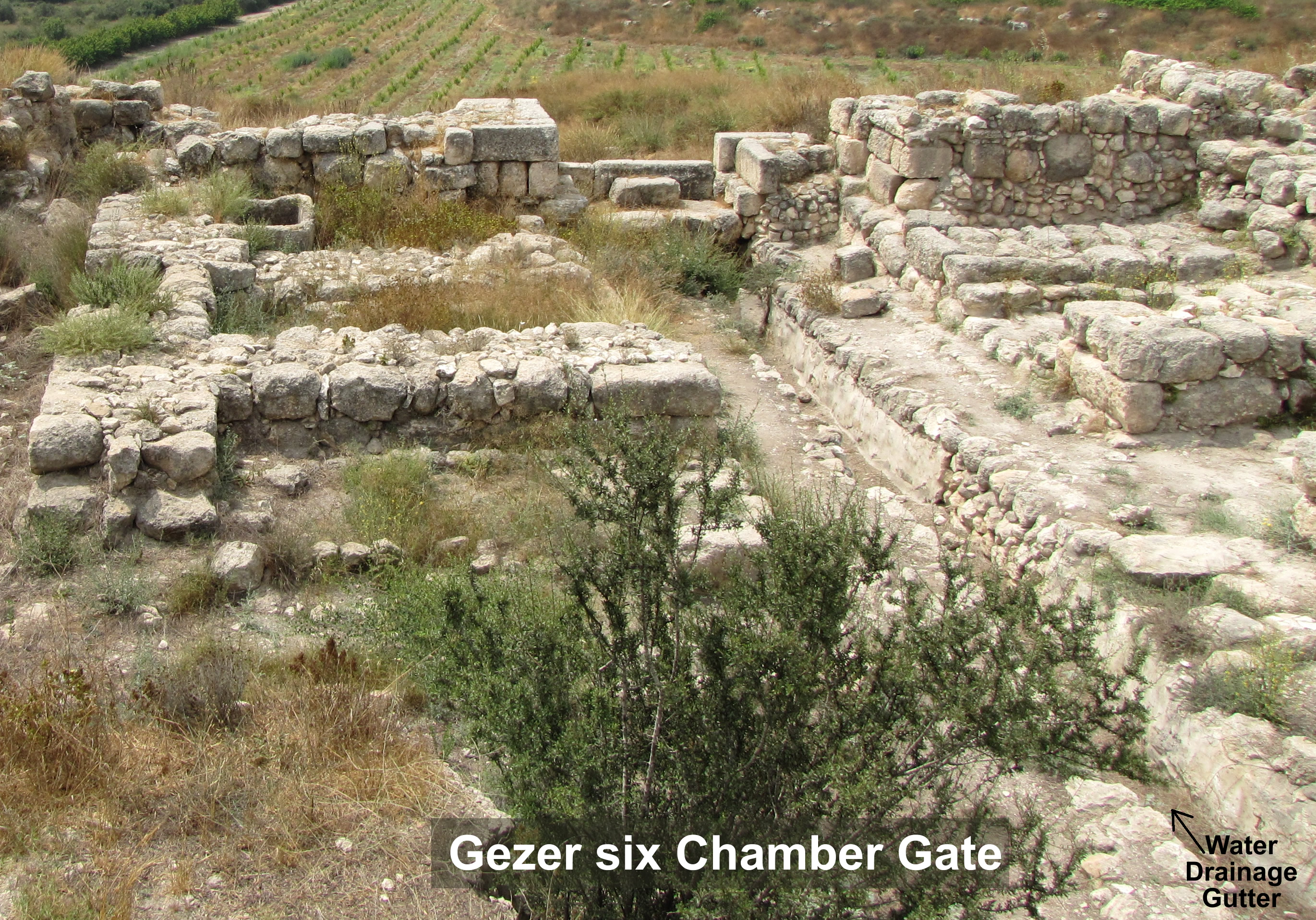
This is a six chamber gate built by Solomon. There are others like this in Hazor and Meggido that we also visited.
We are standing on the inside of the city. The trench in the middle is the gutter for the street and would have been covered with rock slabs. The entrance is at the end of the gutter. On each side of the street are the remains of 3 chambers. This would have been seats for the city government and also the main source of military defenses.
Galyn has just entered the gate.
Notice the gutter (trench) leading out or the city under the main entrance.
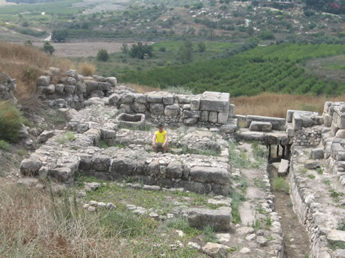
Galyn is headed for a seat in the city gate.
Here Galyn is seated in the city gate of Gezer where the leaders of the ancient city would have sat.
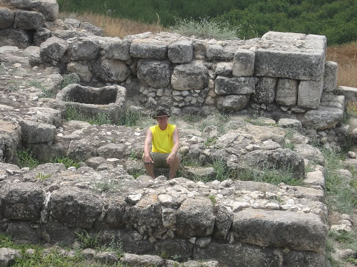
Galyn is seated in the second of the three chambers on the left side of the city gate.
Notice the remains of the city wall directly behind Galyn. On the other side of this wall would have stood one of the two towers used to defend the gate.
In the corner of the first chamber is a small cistern for water storage.
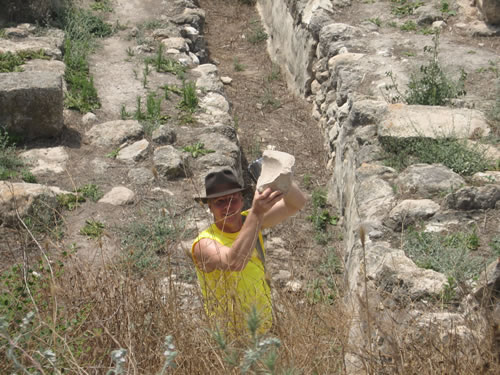
Galyn picks up a piece of pottery for Toni to photograph before he replaces it in the city gate.
Here is a drawing of the city gates at Gezer.
Notice the three chambers on each side, but then notice the two towers (one is drawn in) immediately on the city wall
To the right of the gate is the remains of the city wall and the buildings along the inside
This is one of the memorial stones set up at Gezer.
Many years ago these stones would have been set up at a public ceremony for one of several reasons:
1) Remember an important event as Joshua set up stones from the Jordan in Joshua 4:1-24
2) As a sign of a treaty or covenant with a people.
3) As images to represent the local deities they worshipped.
Here are two more of the memorial stones at Gezer.
The stones may have indicated some kind of treaty among the various tribes of Israel.